MyTopo
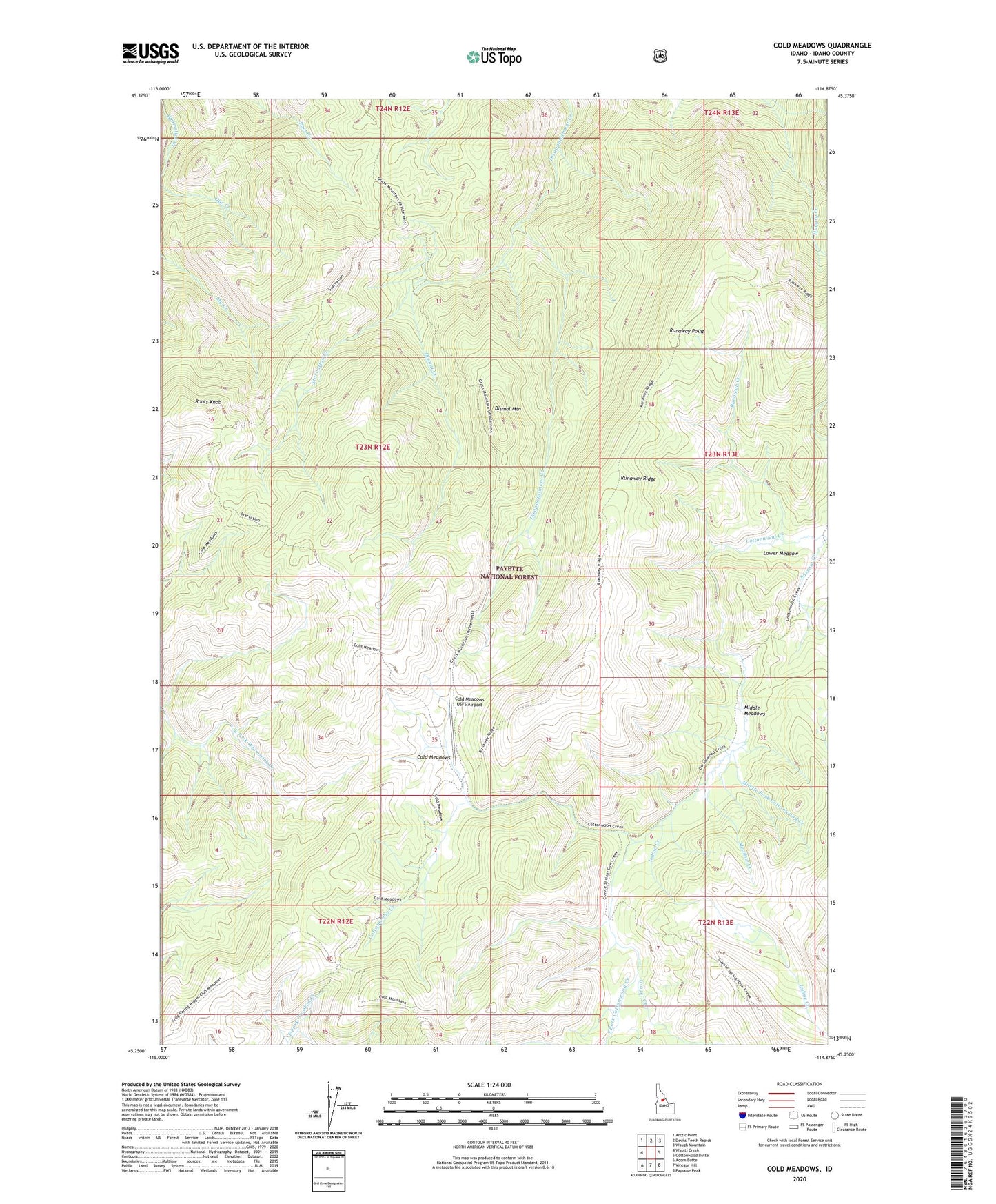
Cold Meadows Idaho US Topo Map
Couldn't load pickup availability
Also explore the Cold Meadows Forest Service Topo of this same quad for updated USFS data
2024 topographic map quadrangle Cold Meadows in the state of Idaho. Scale: 1:24000. Based on the newly updated USGS 7.5' US Topo map series, this map is in the following counties: Idaho. The map contains contour data, water features, and other items you are used to seeing on USGS maps, but also has updated roads and other features. This is the next generation of topographic maps. Printed on high-quality waterproof paper with UV fade-resistant inks.
Quads adjacent to this one:
West: Wapiti Creek
Northwest: Arctic Point
North: Devils Teeth Rapids
Northeast: Waugh Mountain
East: Cottonwood Butte
Southeast: Papoose Peak
South: Vinegar Hill
Southwest: Acorn Butte
This map covers the same area as the classic USGS quad with code o45114c8.
Contains the following named places: Cold Meadows, Cold Meadows Forest Service Station, Cold Meadows USFS Airport, Cottonwood Creek, Dismal Camp, Dismal Creek, Dismal Mountain, Farrow Creek, Ginger Creek, Iodine Creek, Lower Meadow, Meadow Creek, Middle Fork Cottonwood Creek, Middle Meadows, Roots Knob, Runaway Creek, Runaway Point, Runaway Ridge, South Fork Cottonwood Creek, Starvation Creek