MyTopo
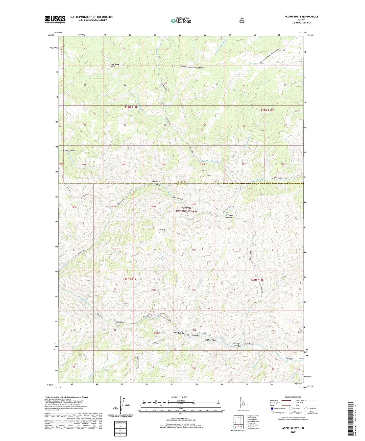
Acorn Butte Idaho US Topo Map
Couldn't load pickup availability
Also explore the Acorn Butte Forest Service Topo of this same quad for updated USFS data
2024 topographic map quadrangle Acorn Butte in the state of Idaho. Scale: 1:24000. Based on the newly updated USGS 7.5' US Topo map series, this map is in the following counties: Idaho, Valley. The map contains contour data, water features, and other items you are used to seeing on USGS maps, but also has updated roads and other features. This is the next generation of topographic maps. Printed on high-quality waterproof paper with UV fade-resistant inks.
Quads adjacent to this one:
West: Bismark Mountain
Northwest: Lodgepole Creek
North: Wapiti Creek
Northeast: Cold Meadows
East: Vinegar Hill
Southeast: Mormon Mountain
South: Monument
Southwest: Center Mountain
This map covers the same area as the classic USGS quad with code o45115b1.
Contains the following named places: Acorn Butte, Acorn Creek, Bar Creek, Bismark Basin, Bismark Creek, Buck Creek, Bull Creek, Cold Meadow Trail, Coxey Creek, Coxey Creek Bar, Coxey Creek Trail, Coxey Hole, Crescent Meadow, East Fork Crooked Creek, Fawn Creek, Frog Spring, Hard Boil Bar, Jensen Cabin, Lime Creek, Mile Flat, Mile Hi, Mile High Ranch, Over Easy Bar, Pack Horse Creek, Routson Creek, Sliver Creek, Sliver Creek Trail, Snowshoe Gulch, Snowshoe Mine, Soft Boil Bar, West Fork Basin, West Fork Crooked Creek