MyTopo
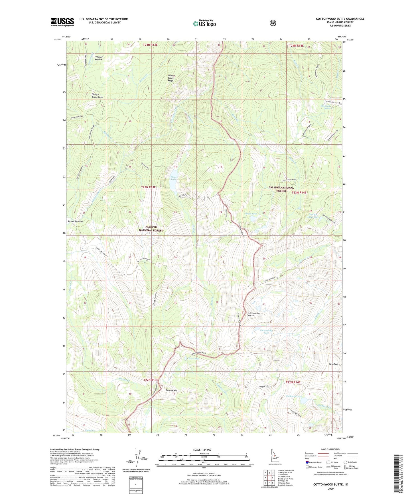
Cottonwood Butte Idaho US Topo Map
Couldn't load pickup availability
Also explore the Cottonwood Butte Forest Service Topo of this same quad for updated USFS data
2024 topographic map quadrangle Cottonwood Butte in the state of Idaho. Scale: 1:24000. Based on the newly updated USGS 7.5' US Topo map series, this map is in the following counties: Idaho. The map contains contour data, water features, and other items you are used to seeing on USGS maps, but also has updated roads and other features. This is the next generation of topographic maps. Printed on high-quality waterproof paper with UV fade-resistant inks.
Quads adjacent to this one:
West: Cold Meadows
Northwest: Devils Teeth Rapids
North: Waugh Mountain
Northeast: Square Top
East: Butts Creek Point
Southeast: Aggipah Mountain
South: Papoose Peak
Southwest: Vinegar Hill
This map covers the same area as the classic USGS quad with code o45114c7.
Contains the following named places: Basin Creek, Basin Lake, Black Lake, Canyon Creek Ridge, Cottonwood Butte, Cottonwood Lake, Farrow Mountain, Farrow Mountain Trail, Grandad Campsite, Hungry Creek Point, Mirage Creek, Peak Creek, Phantom Meadow, Stoddard Lake, Stub Creek Spring, Swamp Angel Lake, Twin Lakes, Twin Peak