MyTopo
Waugh Mountain Idaho US Topo Map
Couldn't load pickup availability
Also explore the Waugh Mountain Forest Service Topo of this same quad for updated USFS data
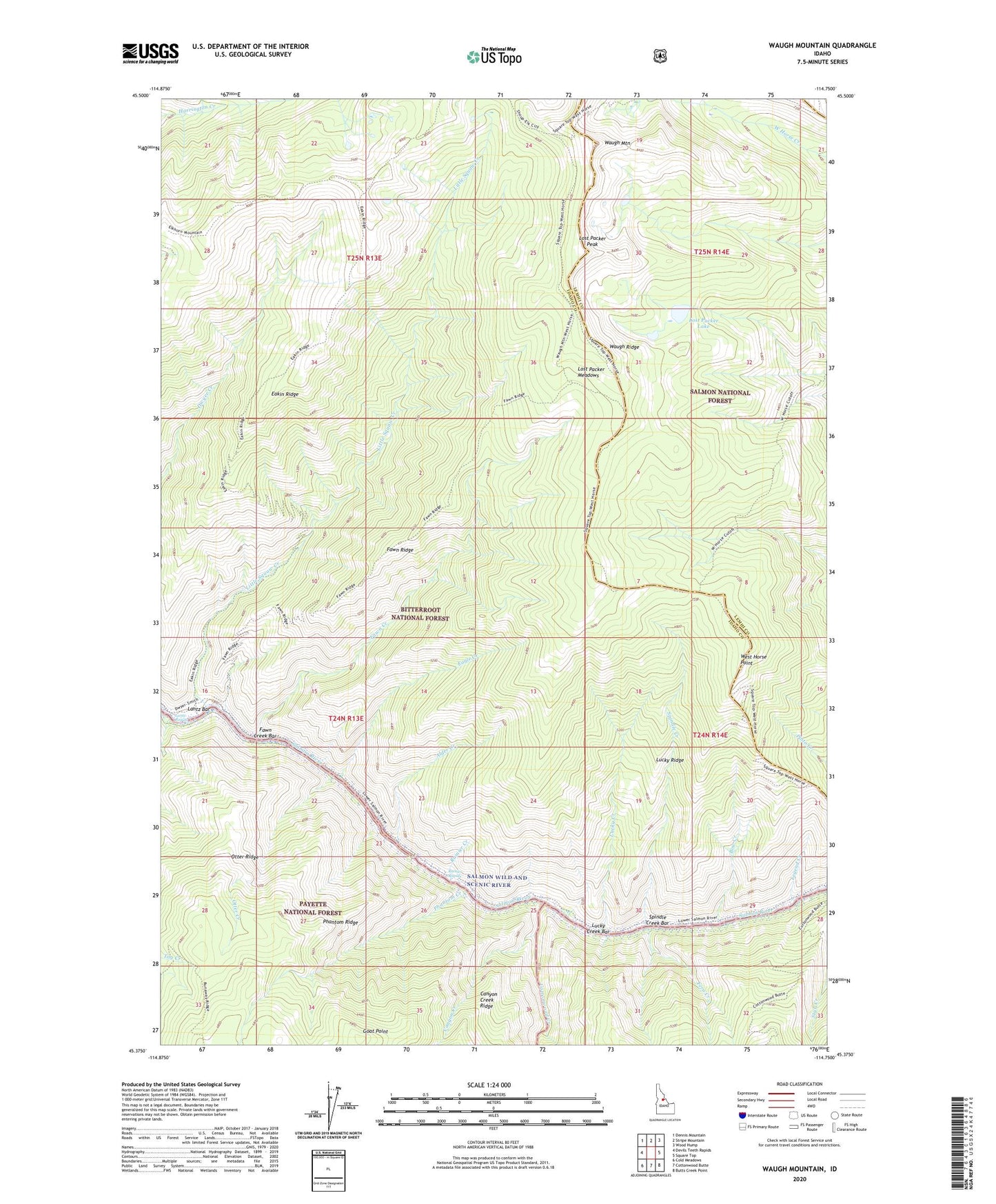
2024 topographic map quadrangle Waugh Mountain in the state of Idaho. Scale: 1:24000. Based on the newly updated USGS 7.5' US Topo map series, this map is in the following counties: Idaho, Lemhi. The map contains contour data, water features, and other items you are used to seeing on USGS maps, but also has updated roads and other features. This is the next generation of topographic maps. Printed on high-quality waterproof paper with UV fade-resistant inks.
Quads adjacent to this one:
West: Devils Teeth Rapids
Northwest: Dennis Mountain
North: Stripe Mountain
Northeast: Wood Hump
East: Square Top
Southeast: Butts Creek Point
South: Cottonwood Butte
Southwest: Cold Meadows
This map covers the same area as the classic USGS quad with code o45114d7.
Contains the following named places: Alder Creek, Bow Creek, Canyon Creek, Cottonwood Creek, Eagle Creek, Eakin Cabin, Eakin Ridge, Fawn Creek, Fawn Creek Bar, Fawn Ridge, Fern Creek, Goat Point, Lantz Bar, Lantz Bar Campsite, Lantz Bar Forest Service Facility, Lantz Bar Recreation Site, Lantz Rapids, Legend Creek, Little Squaw Creek, Lost Packer Lake, Lost Packer Meadows, Lost Packer Peak, Lucky Creek, Lucky Creek Bar, Lucky Ridge, Otter Creek, Otter Ridge, Phantom Creek, Phantom Ridge, Rainier Creek, Rainier Rapids, Spindle Creek, Spindle Creek Bar, Tag Creek, Waugh Mountain, Waugh Ridge, West Horse Point