MyTopo
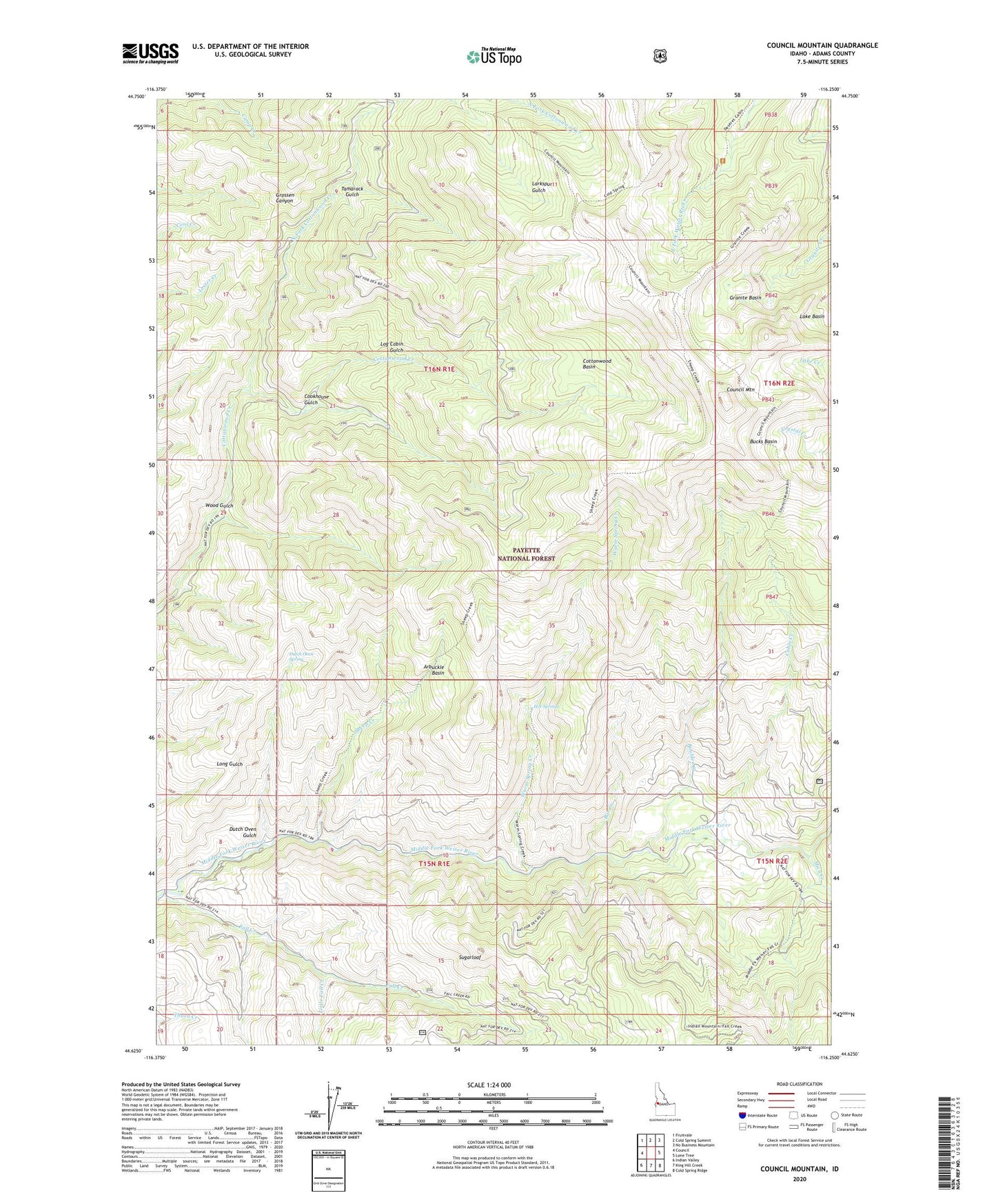
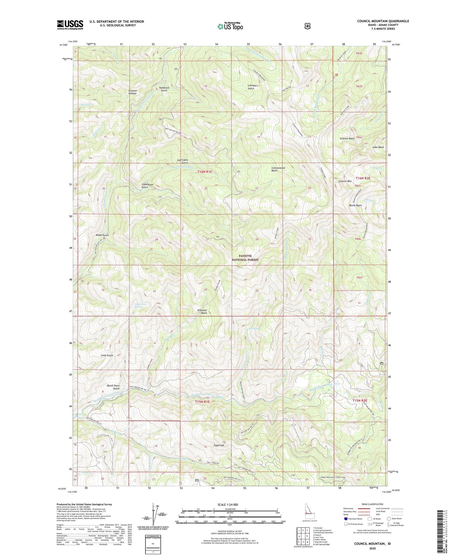
Council Mountain Idaho US Topo Map
Couldn't load pickup availability
Also explore the Council Mountain Forest Service Topo of this same quad for updated USFS data
2024 topographic map quadrangle Council Mountain in the state of Idaho. Scale: 1:24000. Based on the newly updated USGS 7.5' US Topo map series, this map is in the following counties: Adams. The map contains contour data, water features, and other items you are used to seeing on USGS maps, but also has updated roads and other features. This is the next generation of topographic maps. Printed on high-quality waterproof paper with UV fade-resistant inks.
Quads adjacent to this one:
West: Council
Northwest: Fruitvale
North: Cold Spring Summit
Northeast: No Business Mountain
East: Lone Tree
Southeast: Cold Spring Ridge
South: King Hill Creek
Southwest: Indian Valley
This map covers the same area as the classic USGS quad with code o44116f3.
Contains the following named places: Arbuckle Basin, Bar Creek, Boulder Creek, Bucks Basin, Cabin Creek, Cabin Creek Campground, Cabin Creek Trail, Cookhouse Gulch, Cottonwood Basin, Cottonwood Basin Trail, Council Lookout, Council Mountain, Deseret Cabin, Dutch Oven Gulch, Dutch Oven Spring, Fall Creek, Granite Basin, Granite Creek Trail, Hot Springs, Lake Basin, Little Fall Creek, Log Cabin Gulch, Mica Creek, Mica Mine, Mill Creek Trail, North Fork Cottonwood Creek, Sheep Creek, Sugarloaf, Tamarack Gulch, Warm Spring Creek, Wood Gulch