MyTopo
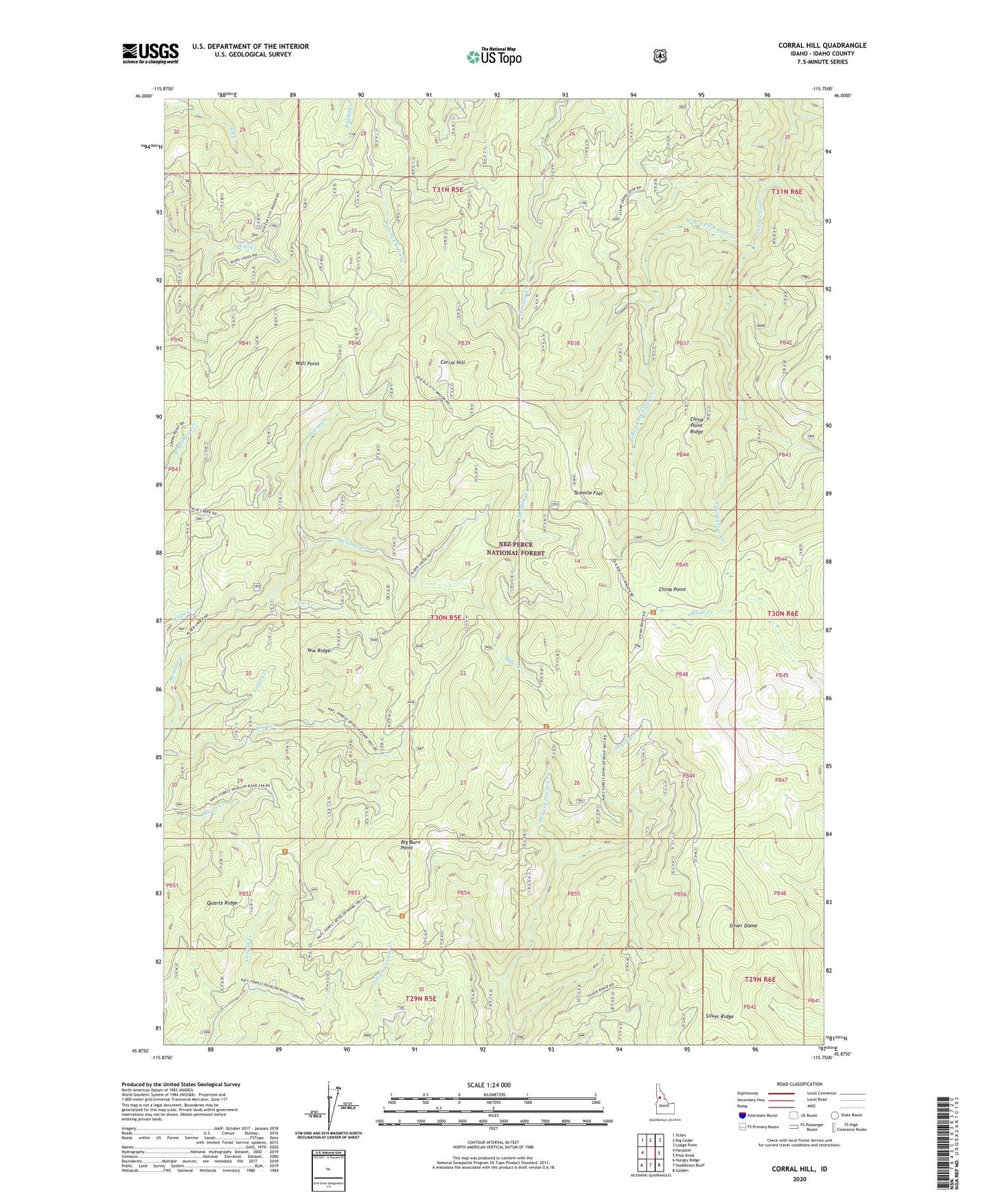
Corral Hill Idaho US Topo Map
Couldn't load pickup availability
Also explore the Corral Hill Forest Service Topo of this same quad for updated USFS data
2024 topographic map quadrangle Corral Hill in the state of Idaho. Scale: 1:24000. Based on the newly updated USGS 7.5' US Topo map series, this map is in the following counties: Idaho. The map contains contour data, water features, and other items you are used to seeing on USGS maps, but also has updated roads and other features. This is the next generation of topographic maps. Printed on high-quality waterproof paper with UV fade-resistant inks.
Quads adjacent to this one:
West: Harpster
Northwest: Stites
North: Big Cedar
Northeast: Lodge Point
East: Pilot Knob
Southeast: Golden
South: Huddleson Bluff
Southwest: Hungry Ridge
This map covers the same area as the classic USGS quad with code o45115h7.
Contains the following named places: Alder Creek, Big Burn Point, China Point, China Point Ridge, Corral Hill, Indian Creek, Silver Dome, Silver Ridge, Storm Creek, Tenmile Flat, Wall Point, West Branch South Fork Clear Creek, West Fork Peasley Creek, Yew Creek, Yew Ridge