MyTopo
Stites Idaho US Topo Map
Couldn't load pickup availability
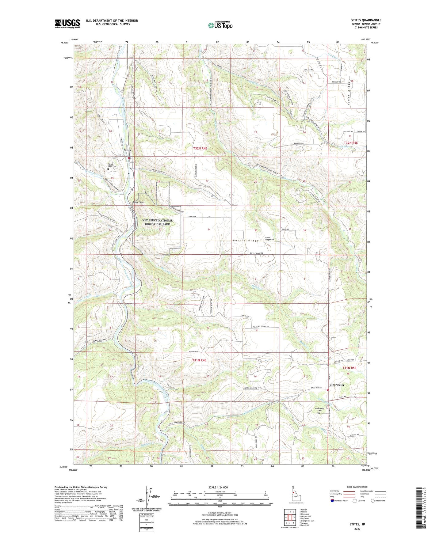
2024 topographic map quadrangle Stites in the state of Idaho. Scale: 1:24000. Based on the newly updated USGS 7.5' US Topo map series, this map is in the following counties: Idaho. The map contains contour data, water features, and other items you are used to seeing on USGS maps, but also has updated roads and other features. This is the next generation of topographic maps. Printed on high-quality waterproof paper with UV fade-resistant inks.
Quads adjacent to this one:
West: Nezperce SE
Northwest: Kamiah
North: Kooskia
Northeast: Glenwood
East: Big Cedar
Southeast: Corral Hill
South: Harpster
Southwest: Grangeville East
This map covers the same area as the classic USGS quad with code o46115a8.
Contains the following named places: Battle Ridge, Battle Ridge - Pleasant Valley - Clearwater Volunteer Rural Fire Department, Battle Ridge Butte Airport, Battle Ridge Cemetery, Big Cedar Creek, Butcher Creek, City of Stites, Clear Creek, Clearwater, Clearwater Battlefield Site, Clearwater Cemetery, Clearwater Valley Junior and Senior High School, Clearwater Valley Primary School, Cottonwood Creek, Dizzy Head, Leitch Creek, Little Cedar Creek, Rabbit Creek, Sally Ann Creek, Sill Creek, Stites, Stites Fire Department, Stites Indian Church Cemetery, Stites IOOF Cemetery, Stites Post Office, Threemile Creek, Wall Creek, ZIP Code: 83552