MyTopo
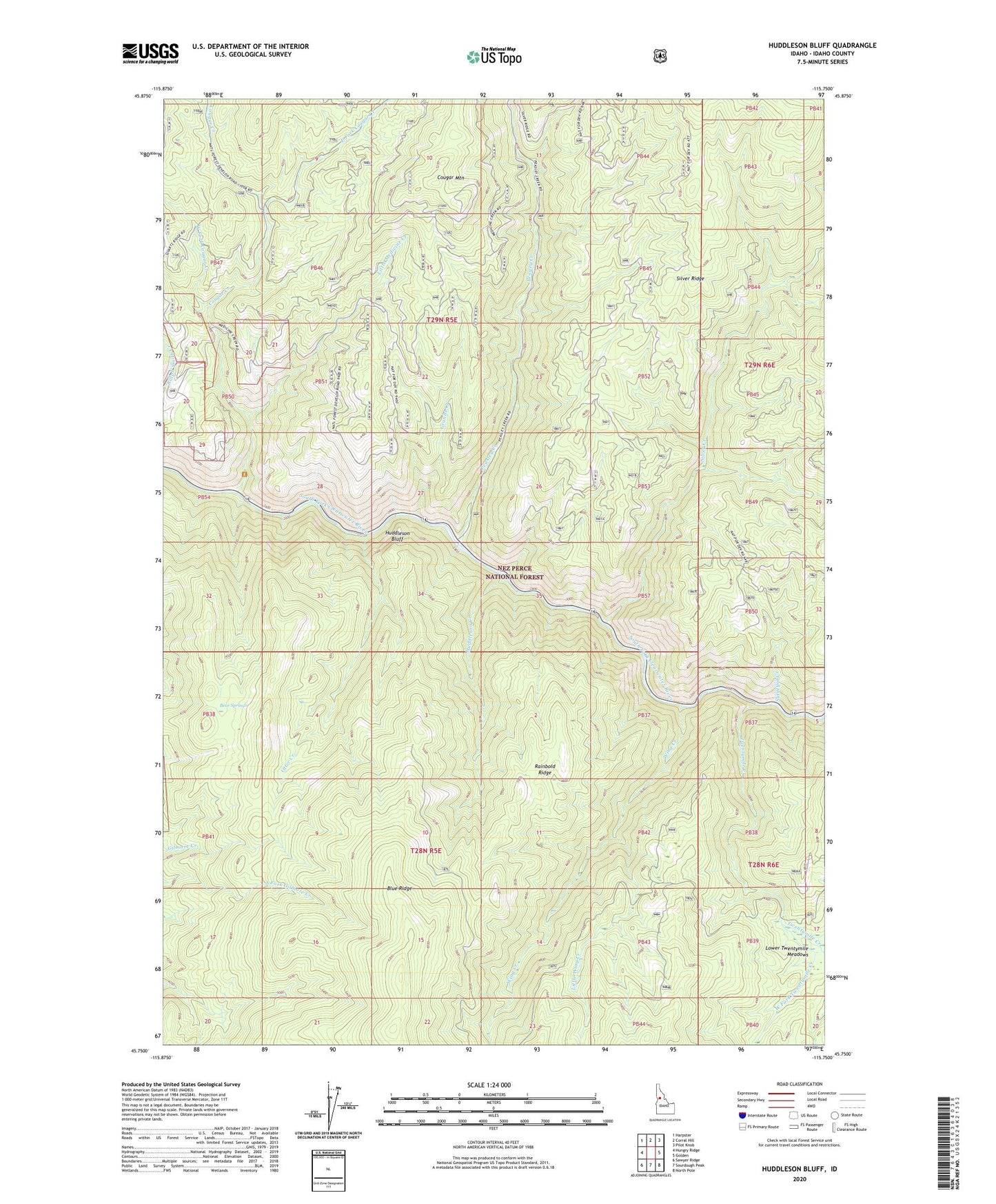
Huddleson Bluff Idaho US Topo Map
Couldn't load pickup availability
Also explore the Huddleson Bluff Forest Service Topo of this same quad for updated USFS data
2024 topographic map quadrangle Huddleson Bluff in the state of Idaho. Scale: 1:24000. Based on the newly updated USGS 7.5' US Topo map series, this map is in the following counties: Idaho. The map contains contour data, water features, and other items you are used to seeing on USGS maps, but also has updated roads and other features. This is the next generation of topographic maps. Printed on high-quality waterproof paper with UV fade-resistant inks.
Quads adjacent to this one:
West: Hungry Ridge
Northwest: Harpster
North: Corral Hill
Northeast: Pilot Knob
East: Golden
Southeast: North Pole
South: Sourdough Peak
Southwest: Sawyer Ridge
This map covers the same area as the classic USGS quad with code o45115g7.
Contains the following named places: Bear Springs, Cougar Creek, Cougar Mountain, East Fork Cougar Creek, Granite Creek, Huddleson Bluff, Huddleson Creek, Little Medicine Creek, Little Wing Creek, Nez Perce National Forest, Otter Creek, Peasley Creek, Rainbold Ridge, Silver Creek, Surveyor Creek, Twentymile Creek, West Fork Cougar Creek, West Fork Twentymile Creek, Wing Creek