MyTopo
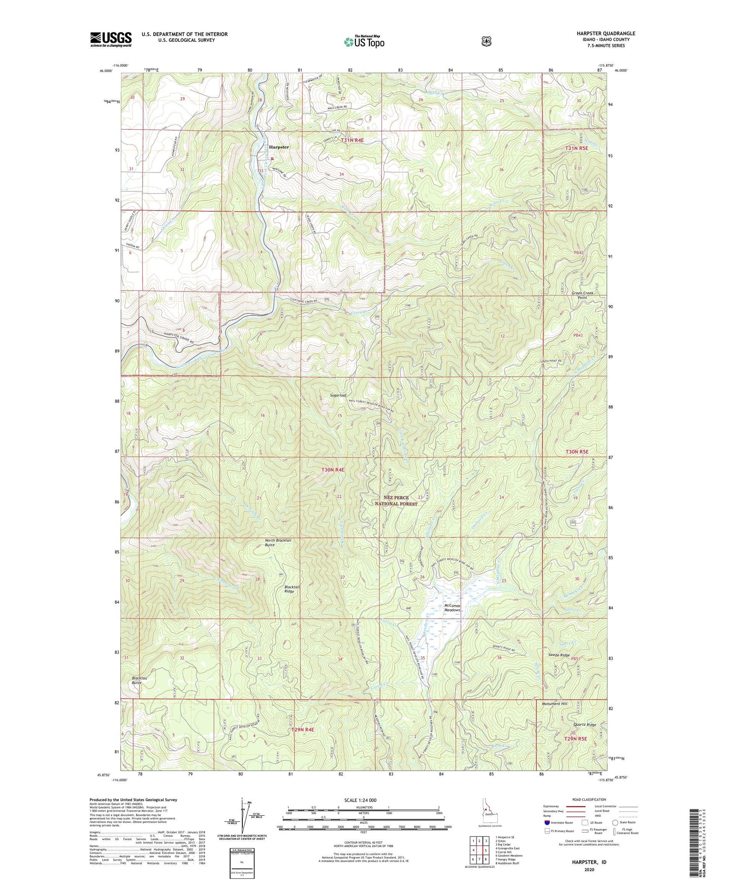
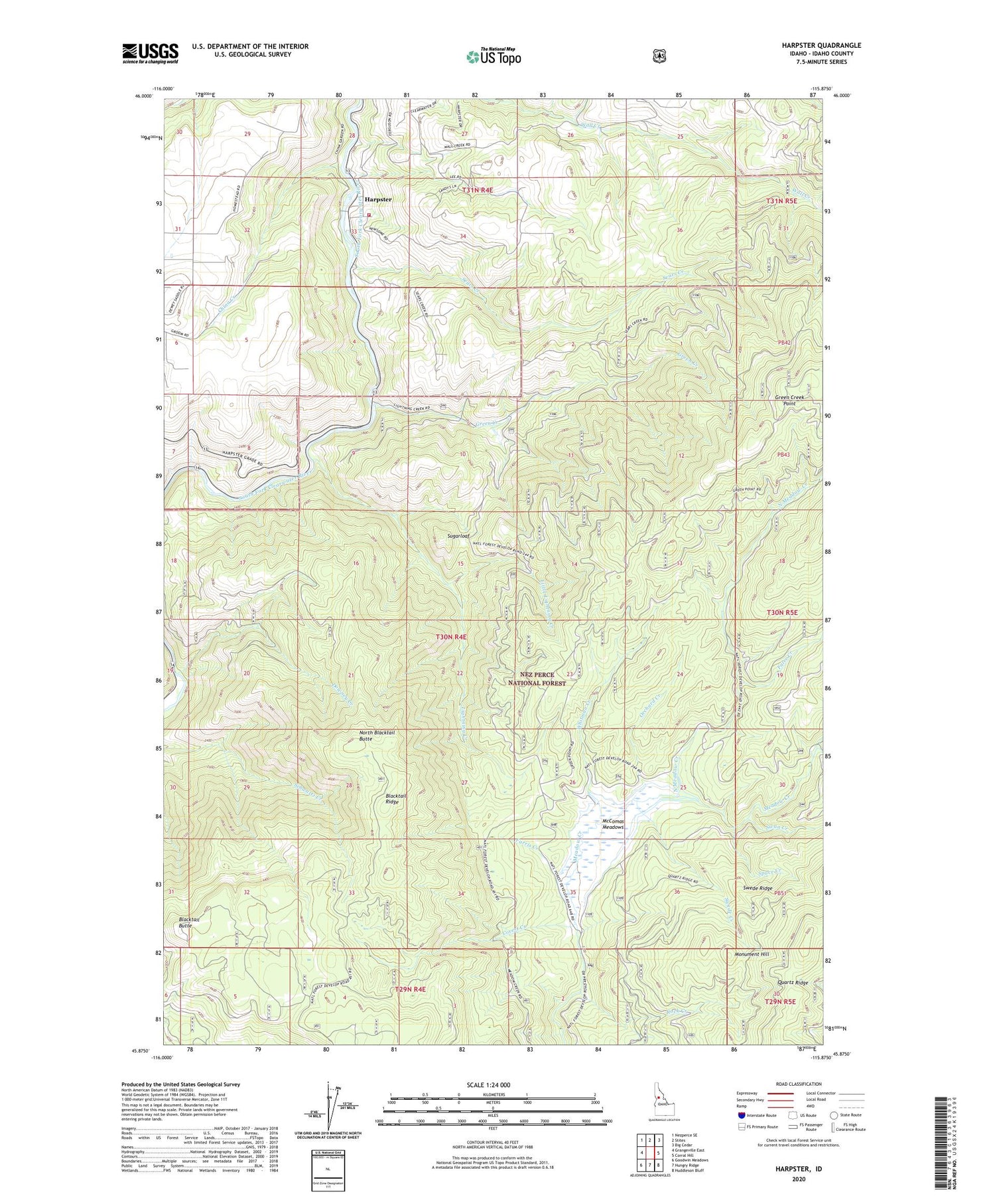
Harpster Idaho US Topo Map
Couldn't load pickup availability
Also explore the Harpster Forest Service Topo of this same quad for updated USFS data
2024 topographic map quadrangle Harpster in the state of Idaho. Scale: 1:24000. Based on the newly updated USGS 7.5' US Topo map series, this map is in the following counties: Idaho. The map contains contour data, water features, and other items you are used to seeing on USGS maps, but also has updated roads and other features. This is the next generation of topographic maps. Printed on high-quality waterproof paper with UV fade-resistant inks.
Quads adjacent to this one:
West: Grangeville East
Northwest: Nezperce SE
North: Stites
Northeast: Big Cedar
East: Corral Hill
Southeast: Huddleson Bluff
South: Hungry Ridge
Southwest: Goodwin Meadows
This map covers the same area as the classic USGS quad with code o45115h8.
Contains the following named places: Blacktail Butte, Blacktail Ridge, China Creek, Covert Creek, Doe Creek, Downey Creek, False Creek, Farris Creek, Green Creek, Green Creek Point, Harpster, Harpster Volunteer Fire Department, Kiddler Place, Lightning Creek, Little Lightning Creek, McComas Meadows, McComas Ranch, Monument Hill, North Blacktail Butte, North Meadow Camp, North Meadow Creek, Orchard Creek, Potlatch Camp 58, Rock Creek, Sears Creek, Space Creek, Sugarloaf, Swan Creek, Swede Creek, Swede Ridge, Whitman Creek