MyTopo
Indian Valley Idaho US Topo Map
Couldn't load pickup availability
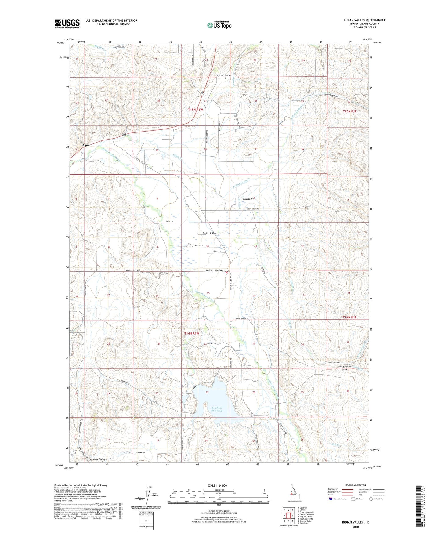
2024 topographic map quadrangle Indian Valley in the state of Idaho. Scale: 1:24000. Based on the newly updated USGS 7.5' US Topo map series, this map is in the following counties: Adams. The map contains contour data, water features, and other items you are used to seeing on USGS maps, but also has updated roads and other features. This is the next generation of topographic maps. Printed on high-quality waterproof paper with UV fade-resistant inks.
Quads adjacent to this one:
West: East of Cambridge
Northwest: Goodrich
North: Council
Northeast: Council Mountain
East: King Hill Creek
Southeast: Twin Sisters
South: Granger Butte
Southwest: Hog Creek Butte
This map covers the same area as the classic USGS quad with code o44116e4.
Contains the following named places: Alpine, Ben Ross Reservoir, C Ben Ross Dam, Dry Creek, Grays Creek, Hillsdale, Hillsdale School, Indian Valley, Indian Valley Cemetery, Indian Valley Post Office, Indian Valley Rural Fire Department, Monday Gulch, North Fork Grays Creek, Ross Gulch, South Fork Grays Creek, Sucker Creek, Thorn Creek, Tiff Lindsay Draw, ZIP Code: 83632