
MyTopo
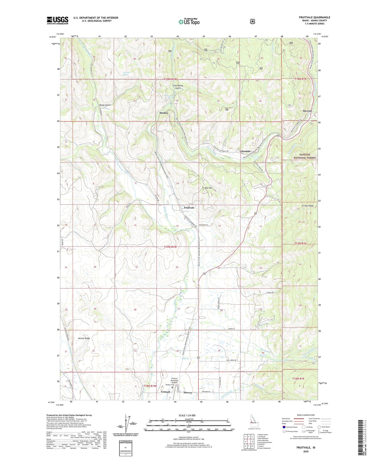
Fruitvale Idaho US Topo Map
Couldn't load pickup availability
Also explore the Fruitvale Forest Service Topo of this same quad for updated USFS data
2024 topographic map quadrangle Fruitvale in the state of Idaho. Scale: 1:24000. Based on the newly updated USGS 7.5' US Topo map series, this map is in the following counties: Adams. The map contains contour data, water features, and other items you are used to seeing on USGS maps, but also has updated roads and other features. This is the next generation of topographic maps. Printed on high-quality waterproof paper with UV fade-resistant inks.
Quads adjacent to this one:
West: Peck Mountain
Northwest: Weasel Gulch
North: Tamarack
Northeast: New Meadows
East: Cold Spring Summit
Southeast: Council Mountain
South: Council
Southwest: Goodrich
This map covers the same area as the classic USGS quad with code o44116g4.
Contains the following named places: Camp Creek, Cold Spring Gulch, Council Municipal Airport, Dale, East Fork Weiser River, Fir Point Spring, Fort Hall Hill, Fort Hall Ridge, Fruitvale, Gaylord Creek, Glendale, Hoover, Hoover Station, Hornet Ridge, Mill Creek, North Fork Mill Creek, Pin Creek, Rocky Gulch, South Fork Mill Creek, Spring Creek, Starkey, Starkey Hot Springs, Starkey Post Office, Stevens, Trail Creek, Trestle Creek, Warm Spring Creek, Warm Spring Gulch, West Fork Weiser River, White School, Winkler Cemetery


