MyTopo
Davis Mountain SW Idaho US Topo Map
Couldn't load pickup availability
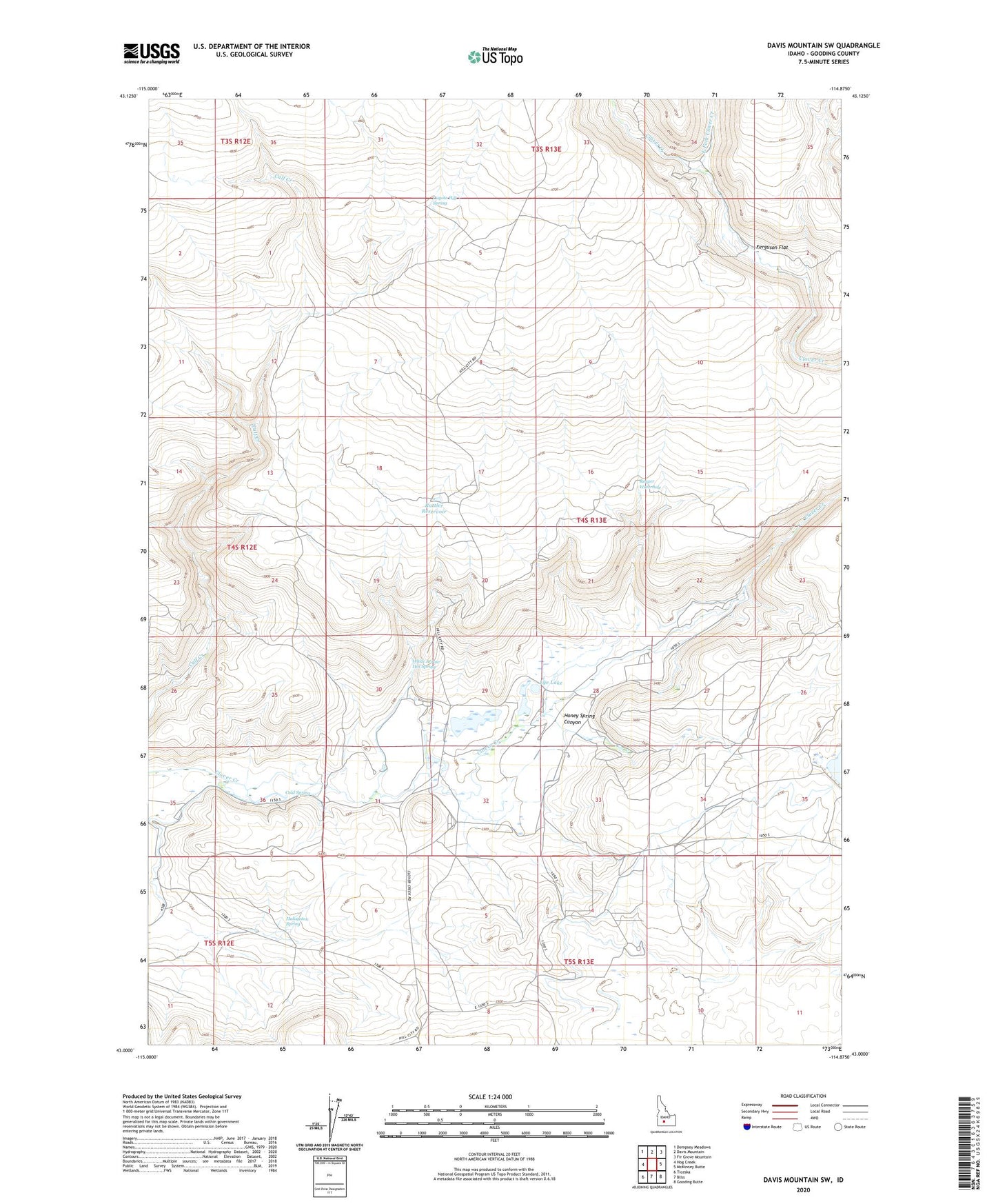
2024 topographic map quadrangle Davis Mountain SW in the state of Idaho. Scale: 1:24000. Based on the newly updated USGS 7.5' US Topo map series, this map is in the following counties: Gooding. The map contains contour data, water features, and other items you are used to seeing on USGS maps, but also has updated roads and other features. This is the next generation of topographic maps. Printed on high-quality waterproof paper with UV fade-resistant inks.
Quads adjacent to this one:
West: Hog Creek
Northwest: Dempsey Meadows
North: Davis Mountain
Northeast: Fir Grove Mountain
East: McKinney Butte
Southeast: Gooding Butte
South: Bliss
Southwest: Ticeska
This map covers the same area as the classic USGS quad with code o43114a8.
Contains the following named places: Bray Lake Dam, Bray Lake Ranch, Cold Spring, Coyote Hill Spring, East Fork Clover Creek, Ferguson Flat, Halogeton Spring, Honey Spring Canyon, Lye Lake, Rattler Reservoir, Reager Waterhole, White Arrow Hot Spring