MyTopo
McKinney Butte Idaho US Topo Map
Couldn't load pickup availability
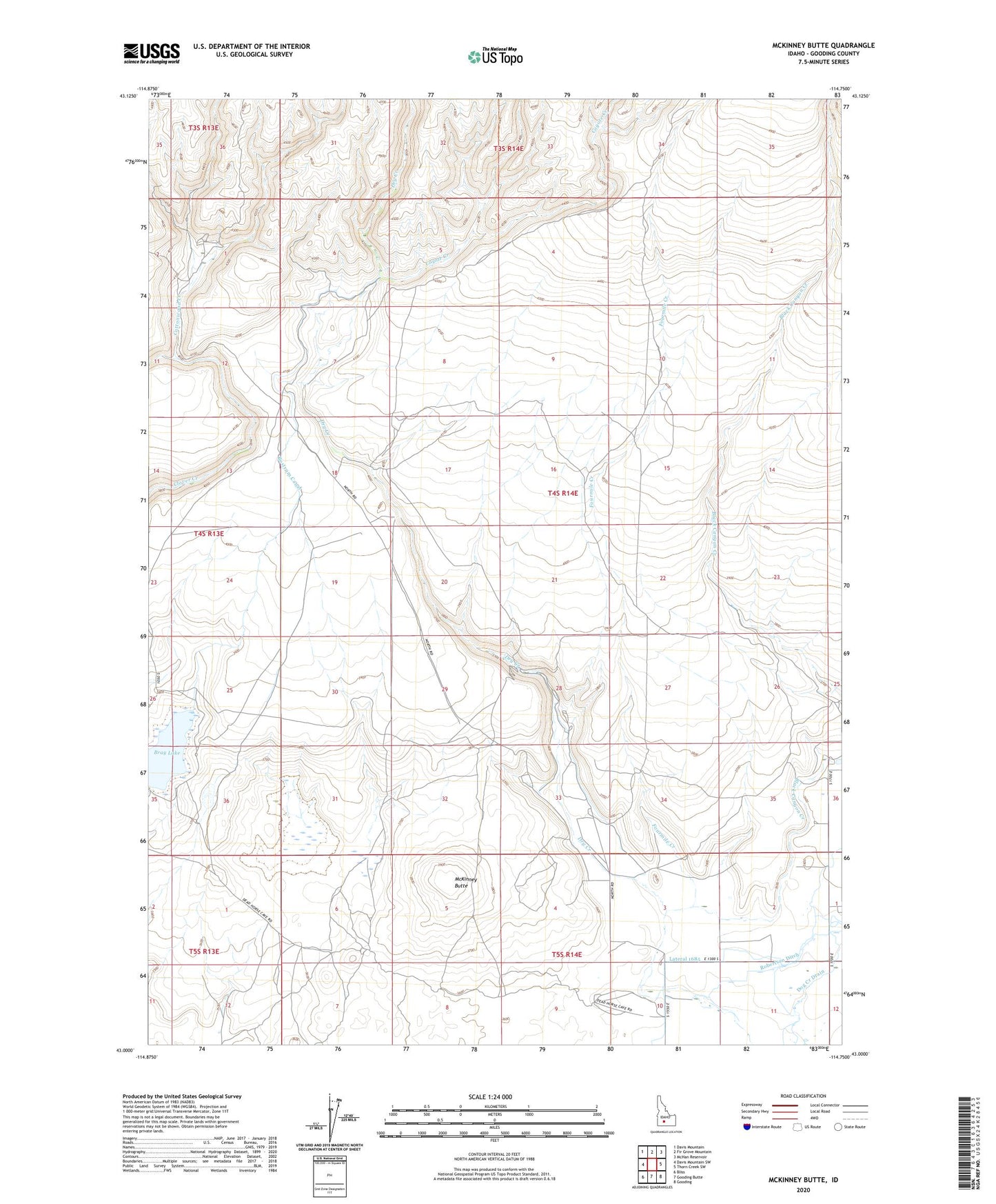
2023 topographic map quadrangle McKinney Butte in the state of Idaho. Scale: 1:24000. Based on the newly updated USGS 7.5' US Topo map series, this map is in the following counties: Gooding. The map contains contour data, water features, and other items you are used to seeing on USGS maps, but also has updated roads and other features. This is the next generation of topographic maps. Printed on high-quality waterproof paper with UV fade-resistant inks.
Quads adjacent to this one:
West: Davis Mountain SW
Northwest: Davis Mountain
North: Fir Grove Mountain
Northeast: McHan Reservoir
East: Thorn Creek SW
Southeast: Gooding
South: Gooding Butte
Southwest: Bliss
This map covers the same area as the classic USGS quad with code o43114a7.
Contains the following named places: Black Canyon Creek, Bliss Division, Bostrum Canal, Bray Lake, Chalk Mine, Cottonwood Creek, Coyote Creek, Crist Cabin, Dog Creek Drain, Fourmile Creek, Hole-In-The-Wall Cabin, Lateral 1665, Lateral 1685, McKinney Butte