MyTopo
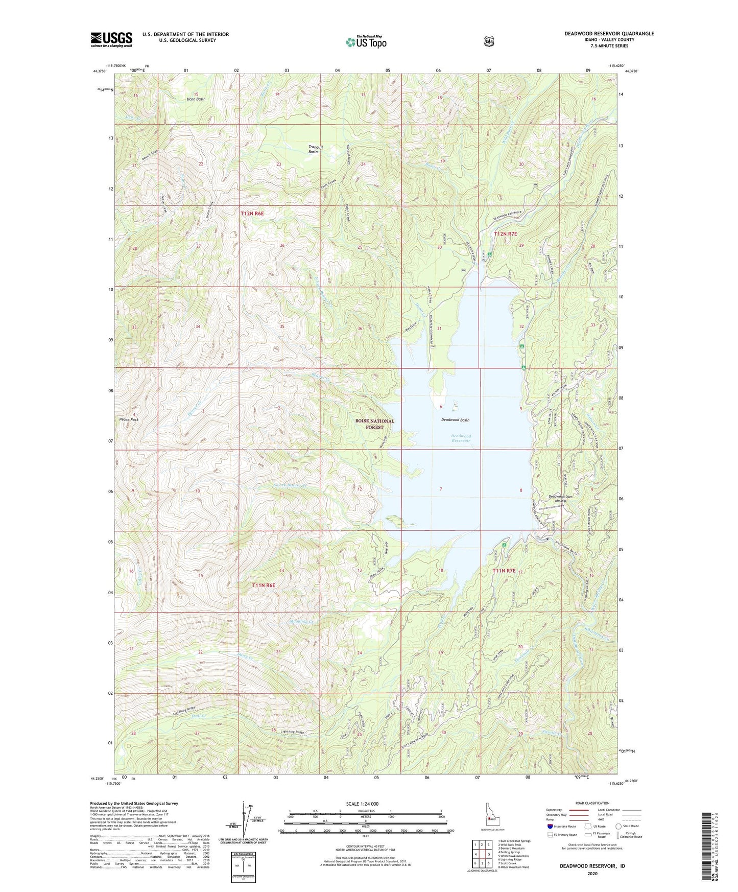
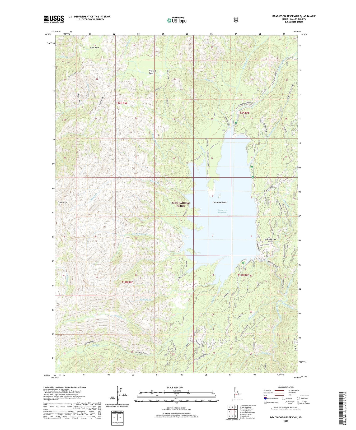
Deadwood Reservoir Idaho US Topo Map
Couldn't load pickup availability
Also explore the Deadwood Reservoir Forest Service Topo of this same quad for updated USFS data
2024 topographic map quadrangle Deadwood Reservoir in the state of Idaho. Scale: 1:24000. Based on the newly updated USGS 7.5' US Topo map series, this map is in the following counties: Valley. The map contains contour data, water features, and other items you are used to seeing on USGS maps, but also has updated roads and other features. This is the next generation of topographic maps. Printed on high-quality waterproof paper with UV fade-resistant inks.
Quads adjacent to this one:
West: Boiling Springs
Northwest: Bull Creek Hot Springs
North: Wild Buck Peak
Northeast: Bernard Mountain
East: Whitehawk Mountain
Southeast: Miller Mountain West
South: Scott Creek
Southwest: Lightning Ridge
This map covers the same area as the classic USGS quad with code o44115c6.
Contains the following named places: Barneys Park Campground, Basin Creek, Beaver Creek, Bummer Creek, Cozy Cove Campground, Daisy Creek, Deadwood Basin, Deadwood Dam, Deadwood Dam Airstrip, Deadwood Reservoir, Fir Springs Campground, Habit Creek, Homers Campground, Lower Deadwood Guard Station, Moulding Creek, North Fork Beaver Creek, Peace Rock, Riverside Campground, Sixmile Creek, South Fork Beaver Creek, Threemile Creek, Trail Creek, Tranquil Basin, Ucon Basin, Warm Springs Creek, West Side Trail, Whitehawk Creek, Wild Buck Creek, Wilson Creek