MyTopo
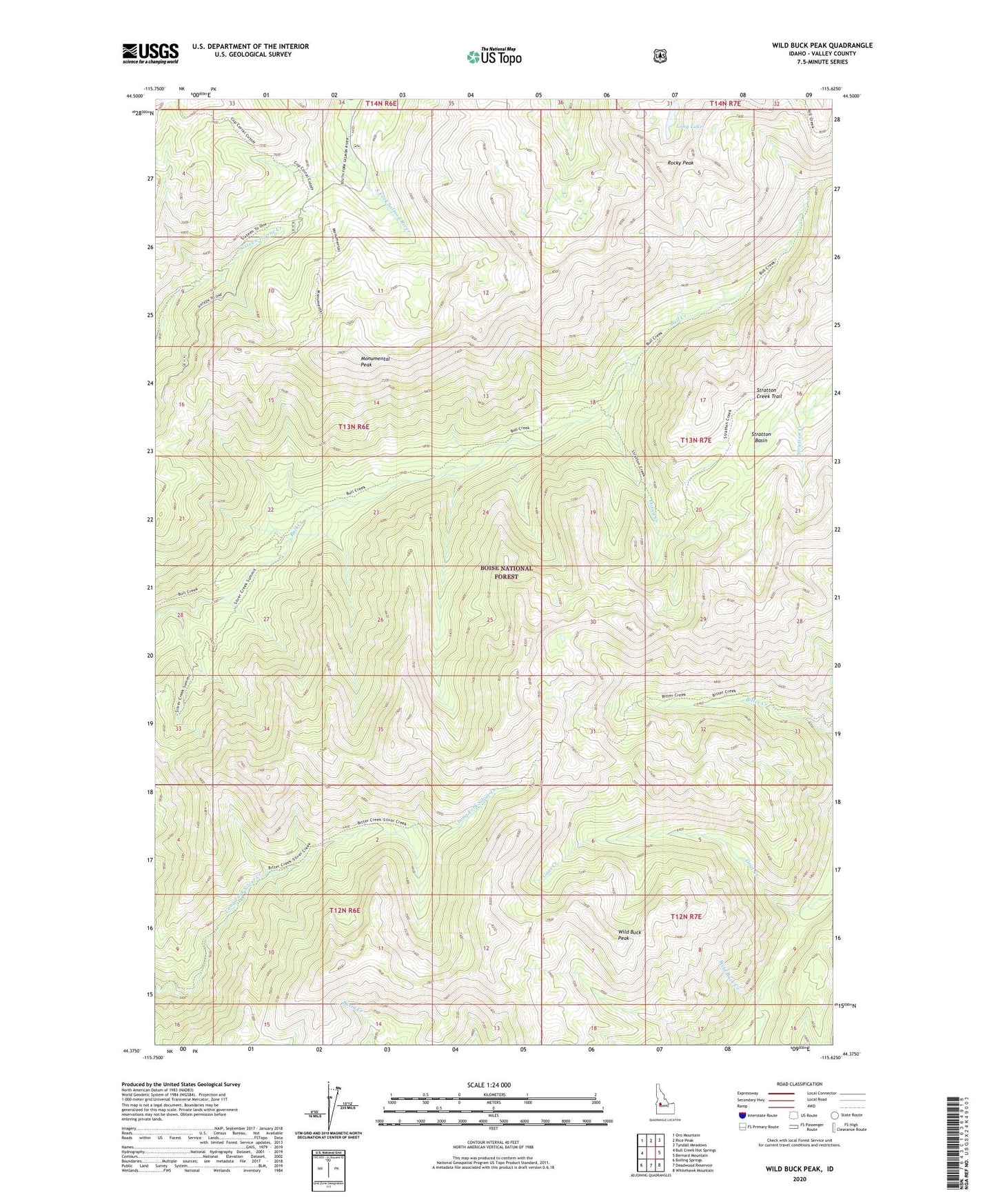
Wild Buck Peak Idaho US Topo Map
Couldn't load pickup availability
Also explore the Wild Buck Peak Forest Service Topo of this same quad for updated USFS data
2024 topographic map quadrangle Wild Buck Peak in the state of Idaho. Scale: 1:24000. Based on the newly updated USGS 7.5' US Topo map series, this map is in the following counties: Valley. The map contains contour data, water features, and other items you are used to seeing on USGS maps, but also has updated roads and other features. This is the next generation of topographic maps. Printed on high-quality waterproof paper with UV fade-resistant inks.
Quads adjacent to this one:
West: Bull Creek Hot Springs
Northwest: Oro Mountain
North: Rice Peak
Northeast: Tyndall Meadows
East: Bernard Mountain
Southeast: Whitehawk Mountain
South: Deadwood Reservoir
Southwest: Boiling Springs
This map covers the same area as the classic USGS quad with code o44115d6.
Contains the following named places: Bull Creek Trail, Cupp Corral, Gem County Stock Trail, Long Lake, Monumental Peak, Monumental Trail, Oxtail Creek, Rocky Peak, Silver Creek Trail, Stratton Basin, Stratton Creek Trail, Wild Buck Peak