MyTopo
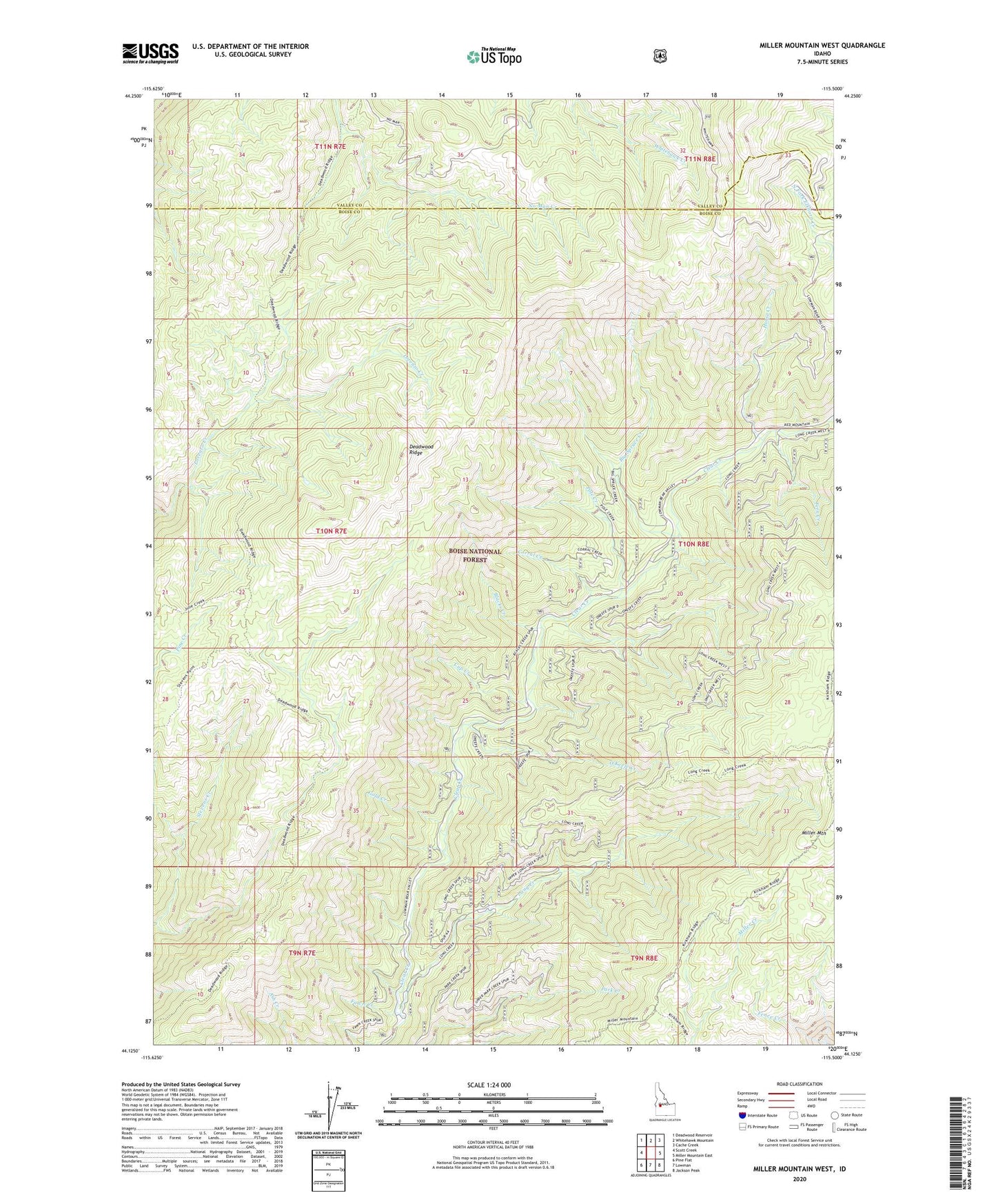
Miller Mountain West Idaho US Topo Map
Couldn't load pickup availability
Also explore the Miller Mountain West Forest Service Topo of this same quad for updated USFS data
2024 topographic map quadrangle Miller Mountain West in the state of Idaho. Scale: 1:24000. Based on the newly updated USGS 7.5' US Topo map series, this map is in the following counties: Boise, Valley. The map contains contour data, water features, and other items you are used to seeing on USGS maps, but also has updated roads and other features. This is the next generation of topographic maps. Printed on high-quality waterproof paper with UV fade-resistant inks.
Quads adjacent to this one:
West: Scott Creek
Northwest: Deadwood Reservoir
North: Whitehawk Mountain
Northeast: Cache Creek
East: Miller Mountain East
Southeast: Jackson Peak
South: Lowman
Southwest: Pine Flat
This map covers the same area as the classic USGS quad with code o44115b5.
Contains the following named places: Big Spruce Creek, Blacks Creek, Corral Creek, Cup Creek, Deadwood Ridge, Fawn Creek, Fern Creek, Gold Creek, Horse Creek, Long Creek, Long Creek Summit Home, O'Keefe Creek, Pole Creek