
MyTopo
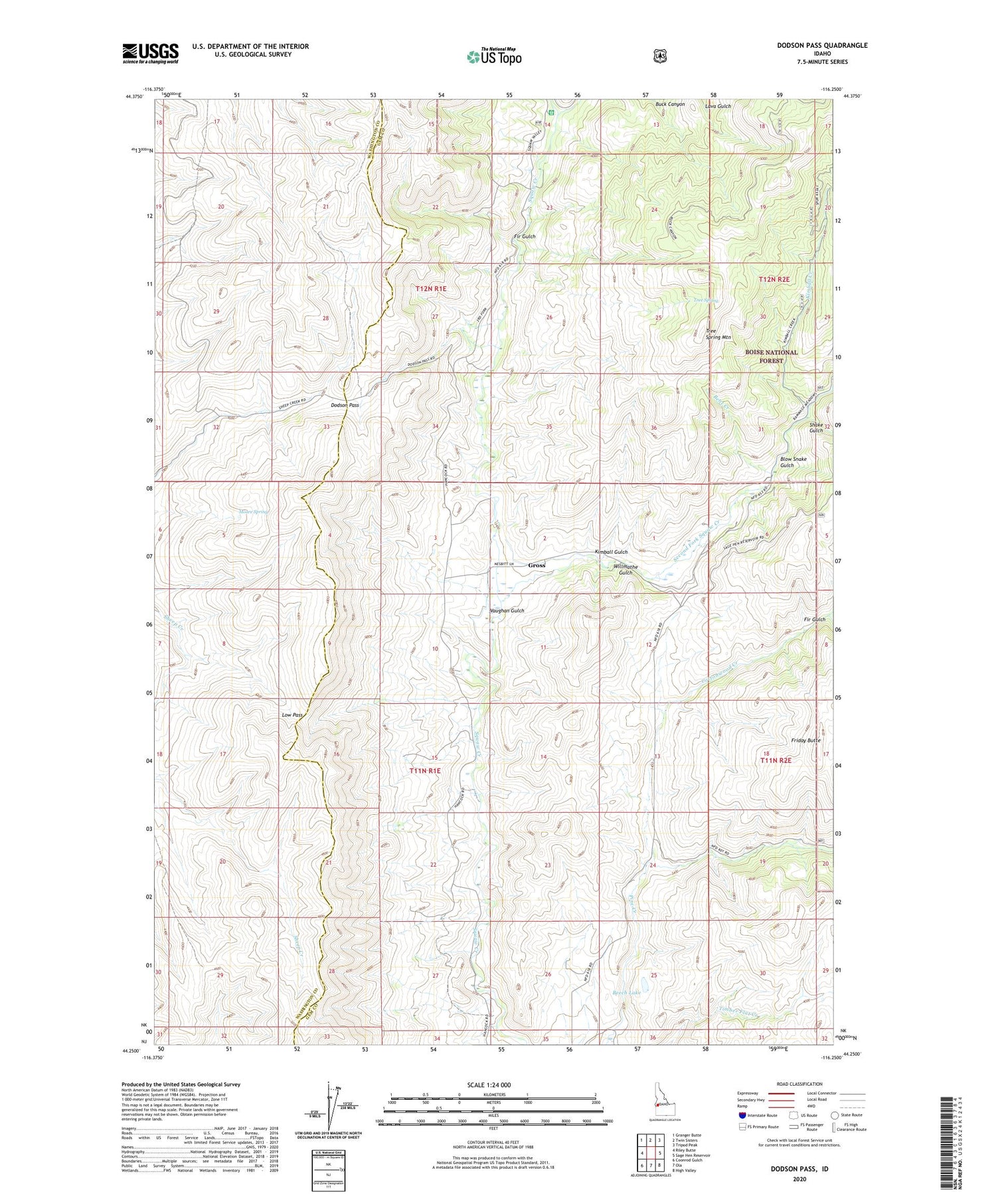
Dodson Pass Idaho US Topo Map
Couldn't load pickup availability
Also explore the Dodson Pass Forest Service Topo of this same quad for updated USFS data
2024 topographic map quadrangle Dodson Pass in the state of Idaho. Scale: 1:24000. Based on the newly updated USGS 7.5' US Topo map series, this map is in the following counties: Gem, Washington. The map contains contour data, water features, and other items you are used to seeing on USGS maps, but also has updated roads and other features. This is the next generation of topographic maps. Printed on high-quality waterproof paper with UV fade-resistant inks.
Quads adjacent to this one:
West: Riley Butte
Northwest: Granger Butte
North: Twin Sisters
Northeast: Tripod Peak
East: Sage Hen Reservoir
Southeast: High Valley
South: Ola
Southwest: Coonrod Gulch
This map covers the same area as the classic USGS quad with code o44116c3.
Contains the following named places: Beech Lake, Bent Creek, Blow Snake Gulch, Cottonwood Creek, Dodson Pass, Fir Gulch, Friday Butte, Gross, Kimball Creek, Kimball Gulch, Low Pass, Moore Spring, Second Fork Squaw Creek, Shake Gulch, Third Fork Guard Station, Third Fork Squaw Creek, Tree Spring, Tree Spring Mountain, Vaughan Gulch, Walker Mill, Willmathe Gulch


