MyTopo
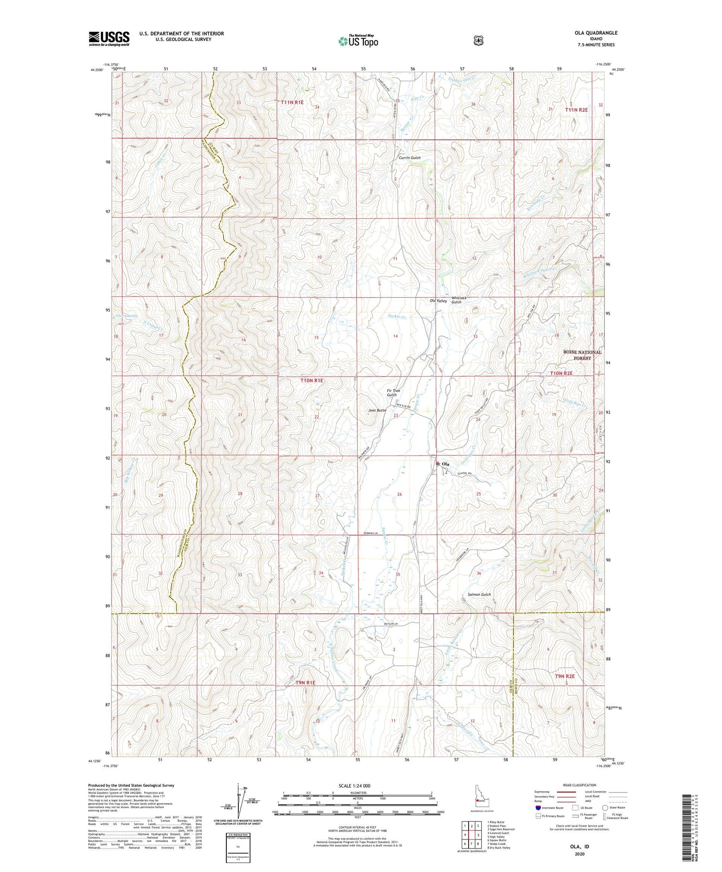
Ola Idaho US Topo Map
Couldn't load pickup availability
Also explore the Ola Forest Service Topo of this same quad for updated USFS data
2024 topographic map quadrangle Ola in the state of Idaho. Scale: 1:24000. Based on the newly updated USGS 7.5' US Topo map series, this map is in the following counties: Gem, Washington, Boise. The map contains contour data, water features, and other items you are used to seeing on USGS maps, but also has updated roads and other features. This is the next generation of topographic maps. Printed on high-quality waterproof paper with UV fade-resistant inks.
Quads adjacent to this one:
West: Coonrod Gulch
Northwest: Riley Butte
North: Dodson Pass
Northeast: Sage Hen Reservoir
East: High Valley
Southeast: Dry Buck Valley
South: Webb Creek
Southwest: Squaw Butte
This map covers the same area as the classic USGS quad with code o44116b3.
Contains the following named places: Cherry Spring, Currin Gulch, Fir Tree Gulch, Gem County Fire District 2 Ola Station, Gold Run Creek, Havord Creek, Joes Butte, Kennedy Creek, Ola, Ola Elementary School, Ola Post Office, Pine Creek, Salmon Gulch, Soldier Creek, Sucker Creek, Timber Flat Creek, Whitlock Gulch, Whitlock Gulch Creek, ZIP Code: 83657