MyTopo
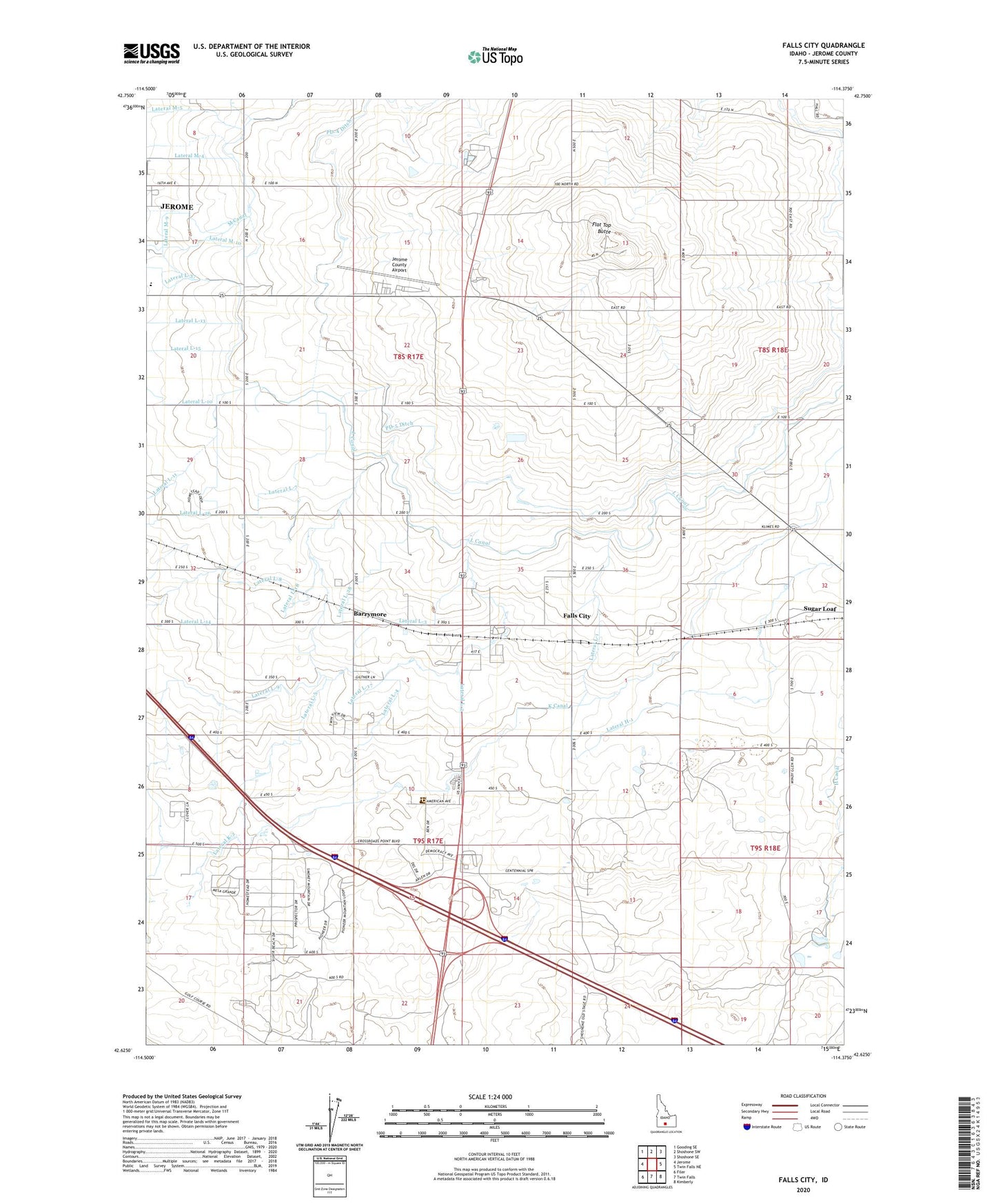
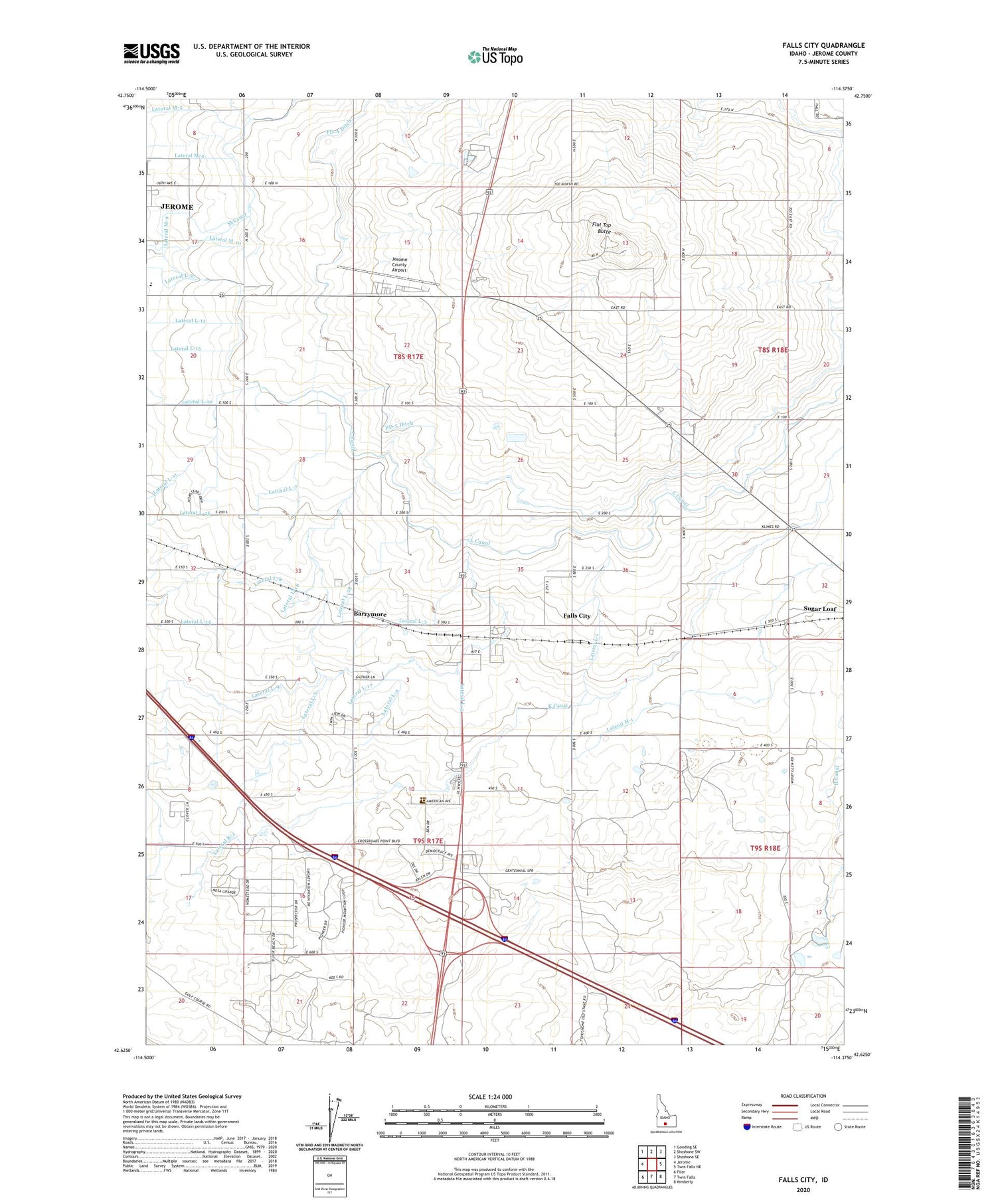
Falls City Idaho US Topo Map
Couldn't load pickup availability
2024 topographic map quadrangle Falls City in the state of Idaho. Scale: 1:24000. Based on the newly updated USGS 7.5' US Topo map series, this map is in the following counties: Jerome. The map contains contour data, water features, and other items you are used to seeing on USGS maps, but also has updated roads and other features. This is the next generation of topographic maps. Printed on high-quality waterproof paper with UV fade-resistant inks.
Quads adjacent to this one:
West: Jerome
Northwest: Gooding SE
North: Shoshone SW
Northeast: Shoshone SE
East: Twin Falls NE
Southeast: Kimberly
South: Twin Falls
Southwest: Filer
This map covers the same area as the classic USGS quad with code o42114f4.
Contains the following named places: Ascension Priory, Barrymore, D Five Ditch, Falls City, Flat Top Butte, Jerome County Airport, Jerome Division, Jerome High School, K Canal, KAWZ-FM (Twin Falls), KBSW-FM (Twin Falls), KEZJ-FM (Twin Falls), KFMA-FM (Jerome), KKVI-TV (Twin Falls), KMVT-TV (Twin Falls), L Canal, Lateral H-1, Lateral K-2, Lateral L-1, Lateral L-16, Lateral L-17, Lateral L-18, Lateral L-2, Lateral L-21, Lateral L-23, Lateral L-24, Lateral L-26, Lateral L-28, Lateral L-29, Lateral L-3, Lateral L-4, Lateral L-5, Lateral L-7, Lateral LA-4, Lateral M-10, Lateral M-9, PD-4 Ditch, PD-5 Ditch, Sugar Loaf, ZIP Code: 83338