MyTopo
Twin Falls Idaho US Topo Map
Couldn't load pickup availability
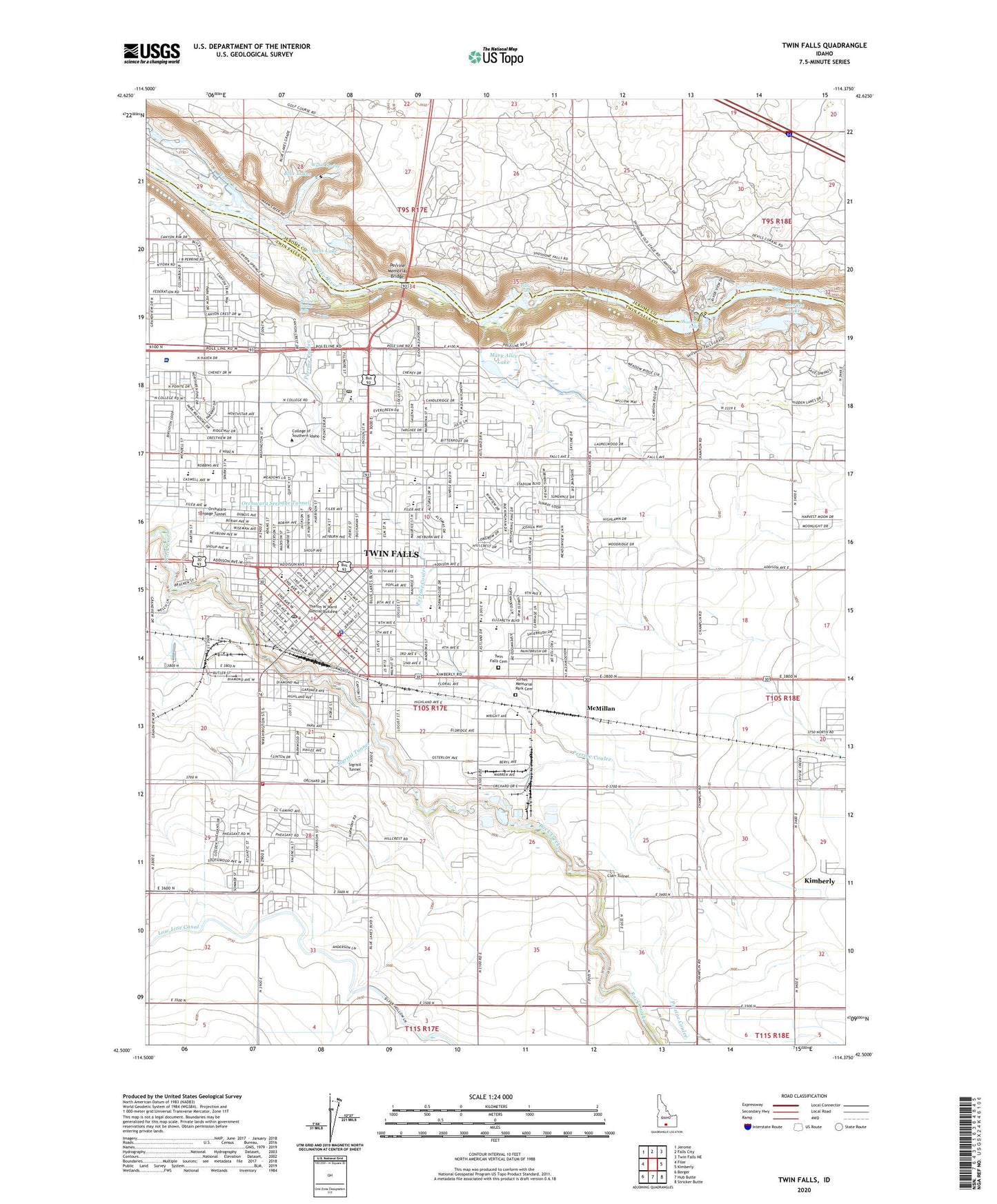
2024 topographic map quadrangle Twin Falls in the state of Idaho. Scale: 1:24000. Based on the newly updated USGS 7.5' US Topo map series, this map is in the following counties: Twin Falls, Jerome. The map contains contour data, water features, and other items you are used to seeing on USGS maps, but also has updated roads and other features. This is the next generation of topographic maps. Printed on high-quality waterproof paper with UV fade-resistant inks.
Quads adjacent to this one:
West: Filer
Northwest: Jerome
North: Falls City
Northeast: Twin Falls NE
East: Kimberly
Southeast: Stricker Butte
South: Hub Butte
Southwest: Berger
This map covers the same area as the classic USGS quad with code o42114e4.
Contains the following named places: Agape Christian School, Ambulance Service of Magic Valley Regional Medical Center Station 2, Barry Park, Bass Lake, Bickel Elementary School, Blue Lakes, Blue Lakes Country Club, Blue Lakes Mall, Blue Lakes Shopping Center, Bureau of Land Management Jarbidge Field Office, Bureau of Land Management Twin Falls District, Canyon View Hospital, Cascade Park, Centennial Waterfront Park, Champlin Farms, City of Twin Falls, Clarr Tunnel, College of Southern Idaho, Dierkes Lake, Dierkes Lake Park, Federation Lookout, Frontier Park, Harmon Park, Harrison Elementary School, Harrison Park, Herrett Museum, Hilltop Seventh Day Adventist School, I B Perrine Elementary School, Immanuel Lutheran School, J-C Park, KAWZ-FM (Twin Falls), KEZJ Radio Tower (Twin Falls), KEZJ-AM (Twin Falls), KLIX-AM (Twin Falls), Lincoln Elementary School, Lynnwood Shopping Center, Magic Valley Alternative High School, Magic Valley Hatchery, Magic Valley Mall, Magic Valley Memorial Hospital, Magic Valley Regional Medical Center Heliport, Magic Valley Speech and Hearing Clinic, Mary Alice Lake, McMillan, McMillan Siding, Memorial School, Morningside Elementary School, National Guard Center, No View Dairy, Orchalara Seepage Tunnel, Perrine Coulee, Perrine Coulee Falls, Perrine Memorial Bridge, Pillar Falls, Robert Stuart Junior High School, Saint Edwards Catholic School, Saint Luke's Magic Valley Regional Medical Center, Sawtooth Elementary School, Shoshone Falls, Shoshone Falls Dam, Shoshone Falls Park, Sigrisit Tunnel, South Central Head Start, Sully, Sunrise Park, Sunset Memorial Park Cemetery, Twin Falls, Twin Falls Cemetery, Twin Falls Christian Academy, Twin Falls City Hall, Twin Falls County Courthouse, Twin Falls County Sheriff's Office, Twin Falls Division, Twin Falls Downtown Post Office, Twin Falls Fire Department Station 1, Twin Falls Fire Department Station 2, Twin Falls Fire Department Station 3, Twin Falls High School, Twin Falls Police Department, Twin Falls Post Office, Twin Falls Senior High School, Vera C O'Leary Junior High School, Vera O'Leary Junior High School, Warm Spring, Washington School