MyTopo
Fish Creek Reservoir Idaho US Topo Map
Couldn't load pickup availability
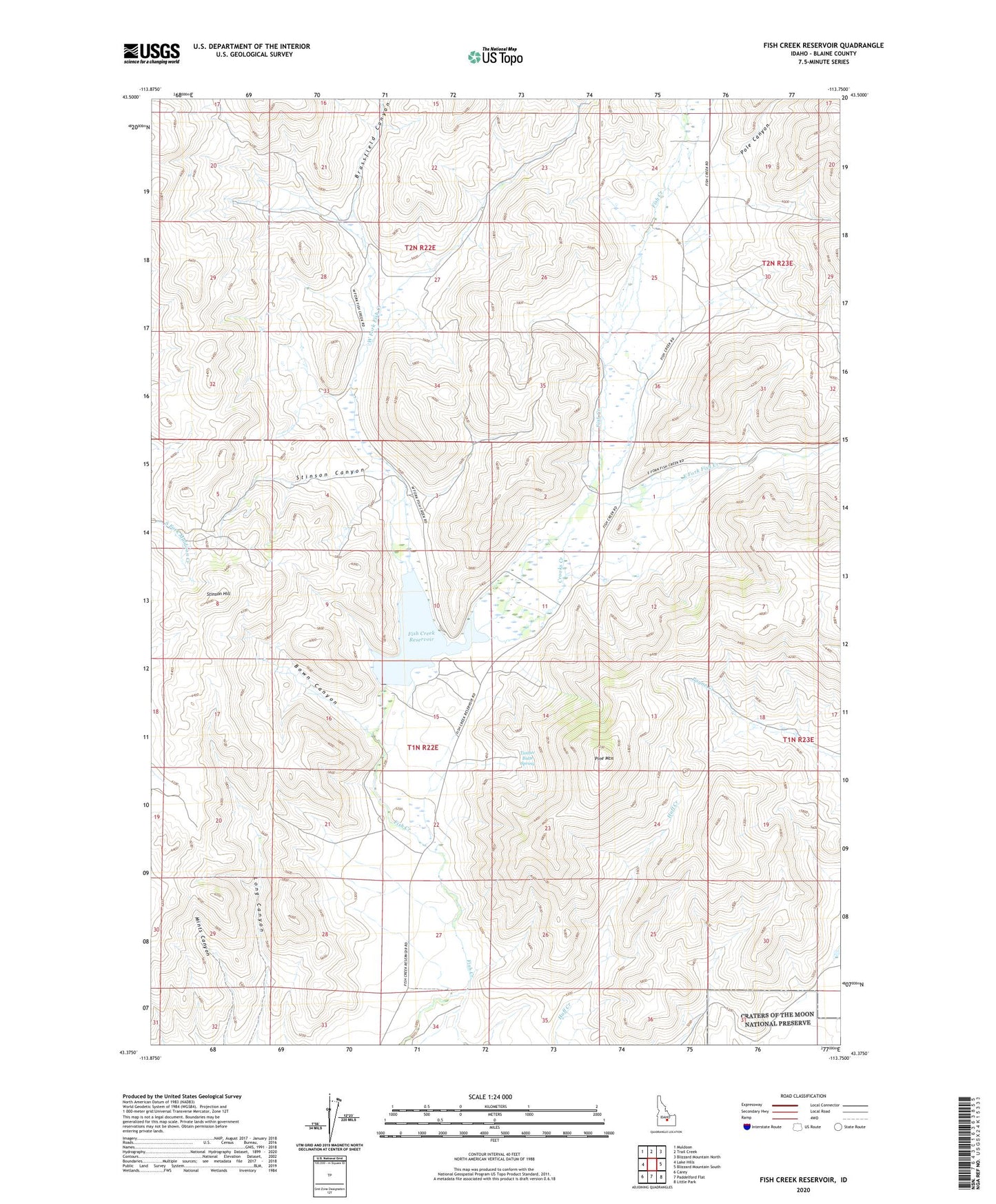
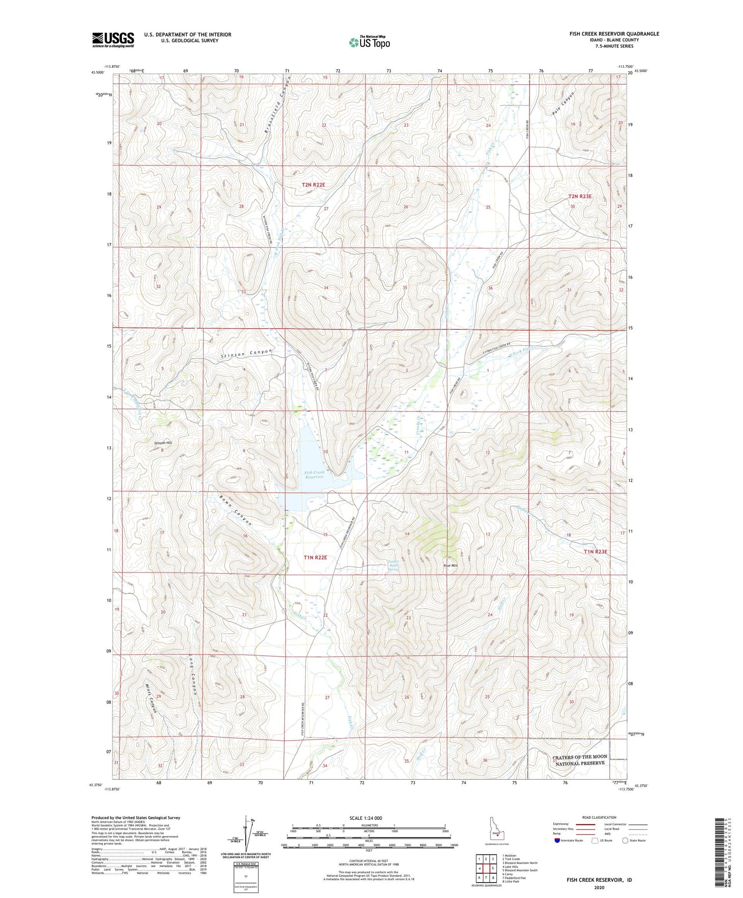
2024 topographic map quadrangle Fish Creek Reservoir in the state of Idaho. Scale: 1:24000. Based on the newly updated USGS 7.5' US Topo map series, this map is in the following counties: Blaine. The map contains contour data, water features, and other items you are used to seeing on USGS maps, but also has updated roads and other features. This is the next generation of topographic maps. Printed on high-quality waterproof paper with UV fade-resistant inks.
Quads adjacent to this one:
West: Lake Hills
Northwest: Muldoon
North: Trail Creek
Northeast: Blizzard Mountain North
East: Blizzard Mountain South
Southeast: Little Park
South: Paddelford Flat
Southwest: Carey
This map covers the same area as the classic USGS quad with code o43113d7.
Contains the following named places: Bown Canyon, Brassfield Canyon, Crooks Creek, East Fork Fish Creek, Fish Creek Dam, Fish Creek Reservoir, Fish Creek Reservoir Access Area, Payne Creek, Pine Mountain, Pole Canyon, Stinson Canyon, Stinson Hill, Timber Butte Spring, West Fork Fish Creek, ZIP Code: 83320