MyTopo
Lake Hills Idaho US Topo Map
Couldn't load pickup availability
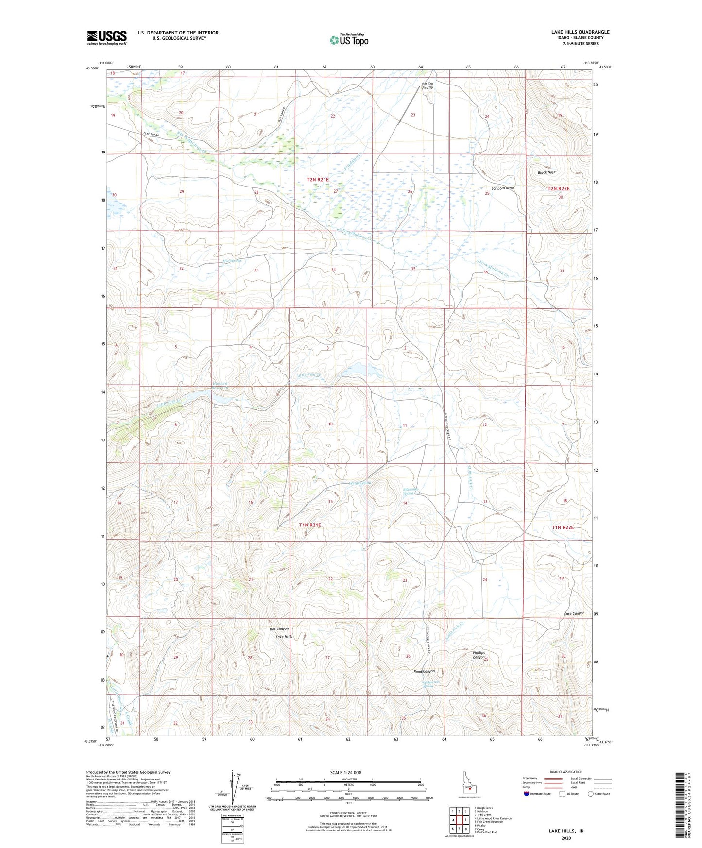
2023 topographic map quadrangle Lake Hills in the state of Idaho. Scale: 1:24000. Based on the newly updated USGS 7.5' US Topo map series, this map is in the following counties: Blaine. The map contains contour data, water features, and other items you are used to seeing on USGS maps, but also has updated roads and other features. This is the next generation of topographic maps. Printed on high-quality waterproof paper with UV fade-resistant inks.
Quads adjacent to this one:
West: Little Wood River Reservoir
Northwest: Baugh Creek
North: Muldoon
Northeast: Trail Creek
East: Fish Creek Reservoir
Southeast: Paddelford Flat
South: Carey
Southwest: Picabo
This map covers the same area as the classic USGS quad with code o43113d8.
Contains the following named places: Albrethsen Dam, Billingsley Spring, Black Nose, Blaine County, Cameron Reservoir, East Canal, Flat Top Airstrip, Friedman Creek, Howard Dam, Howard Reservoir, Lake Hills, Mud Springs, Scribbin Draw, South Fork Muldoon Creek, Watercress Spring, Weigle Pond, West Canal