MyTopo
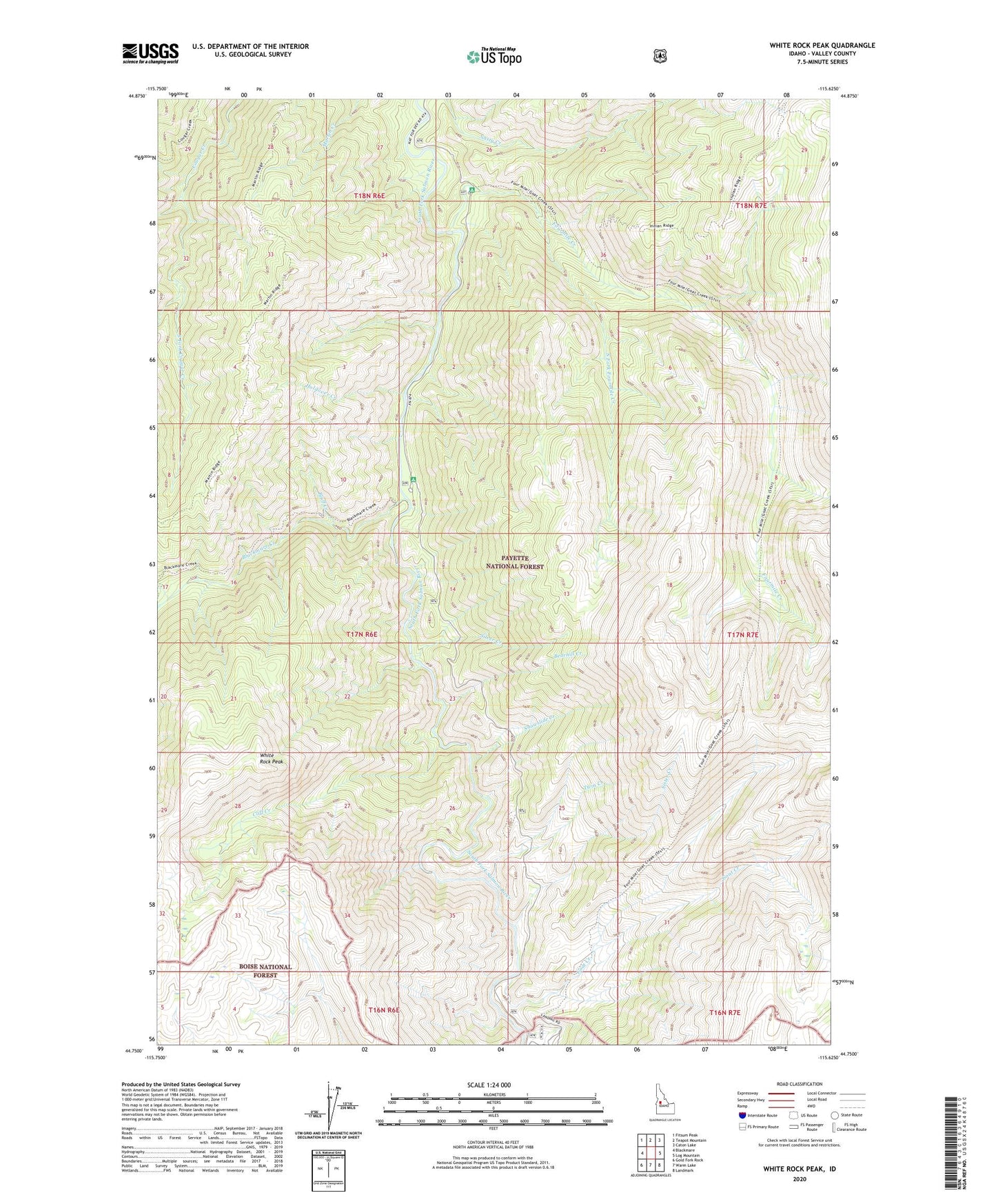
White Rock Peak Idaho US Topo Map
Couldn't load pickup availability
Also explore the White Rock Peak Forest Service Topo of this same quad for updated USFS data
2024 topographic map quadrangle White Rock Peak in the state of Idaho. Scale: 1:24000. Based on the newly updated USGS 7.5' US Topo map series, this map is in the following counties: Valley. The map contains contour data, water features, and other items you are used to seeing on USGS maps, but also has updated roads and other features. This is the next generation of topographic maps. Printed on high-quality waterproof paper with UV fade-resistant inks.
Quads adjacent to this one:
West: Blackmare
Northwest: Fitsum Peak
North: Teapot Mountain
Northeast: Caton Lake
East: Log Mountain
Southeast: Landmark
South: Warm Lake
Southwest: Gold Fork Rock
This map covers the same area as the classic USGS quad with code o44115g6.
Contains the following named places: Bearhill Creek, Blackmare Creek, Blackmare Cutoff Trail, Blackmare Trail, Bluff Creek, Cliff Creek, Cougar Ridge Trail, Fourmile Campground, Fourmile Creek, Fourmile Creek Trail, Goat Creek, Holdover Creek, Lodgepole Campground, Lodgepole Roadside Park, Log Mountain Trail, Nasty Creek, Poverty Flat Campground, Silver Creek, Sister Creek, Snowslide Creek, South Fork Blackmare Creek, South Fork Cougar Creek, South Fork Fourmile Creek, Twin Creek, White Rock Peak