MyTopo
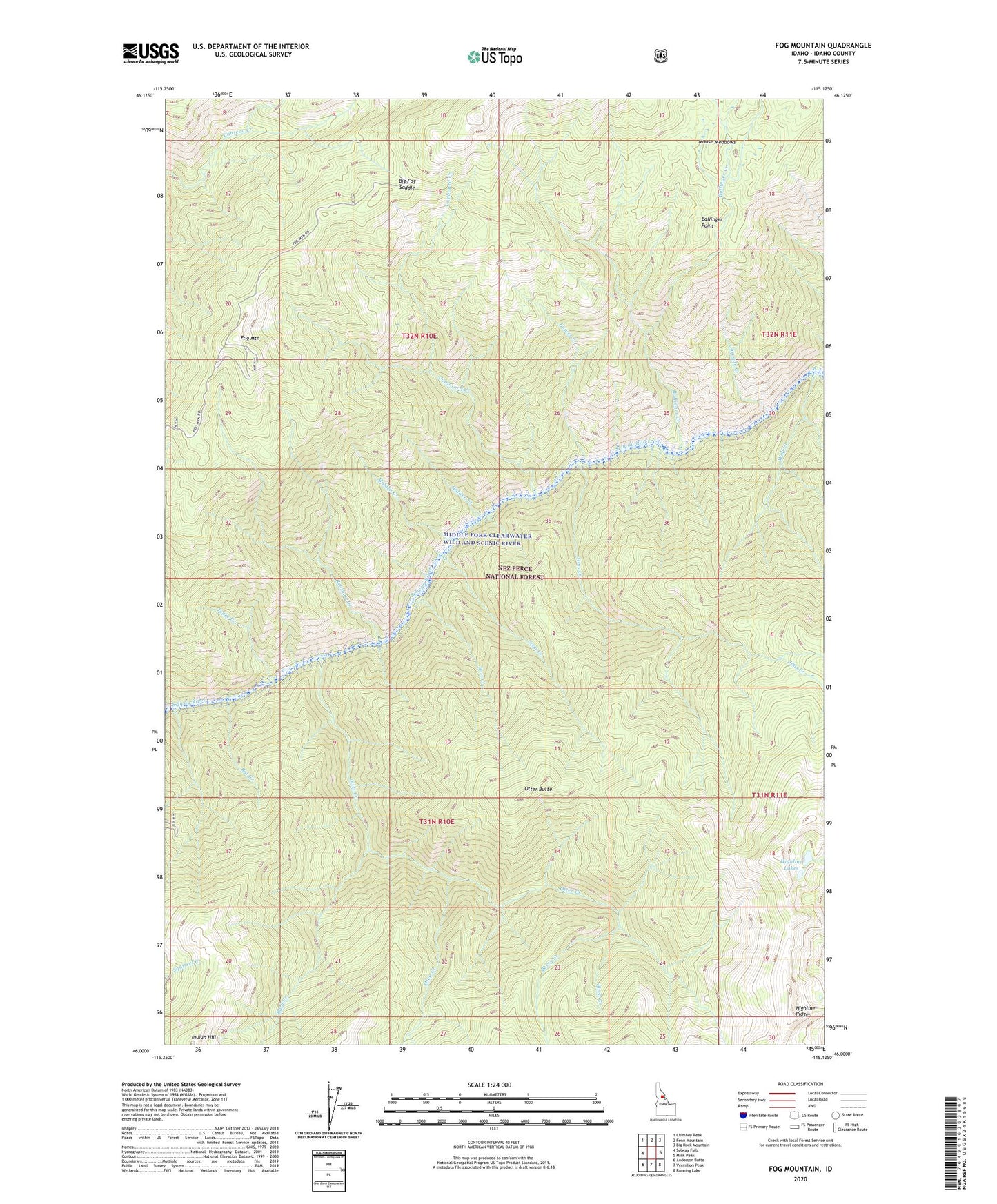
Fog Mountain Idaho US Topo Map
Couldn't load pickup availability
Also explore the Fog Mountain Forest Service Topo of this same quad for updated USFS data
2024 topographic map quadrangle Fog Mountain in the state of Idaho. Scale: 1:24000. Based on the newly updated USGS 7.5' US Topo map series, this map is in the following counties: Idaho. The map contains contour data, water features, and other items you are used to seeing on USGS maps, but also has updated roads and other features. This is the next generation of topographic maps. Printed on high-quality waterproof paper with UV fade-resistant inks.
Quads adjacent to this one:
West: Selway Falls
Northwest: Chimney Peak
North: Fenn Mountain
Northeast: Big Rock Mountain
East: Mink Peak
Southeast: Running Lake
South: Vermilion Peak
Southwest: Anderson Butte
This map covers the same area as the classic USGS quad with code o46115a2.
Contains the following named places: Bait Creek, Ballinger Creek, Ballinger Point, Bat Creek, Berry Creek, Big Fog Saddle, Birch Creek, Bluff Creek, Cascade Creek, Coon Creek, Cupboard Creek, Fog Mountain, Hidden Creek, Highline Lakes, Jims Creek, Maiden Creek, Mica Creek, Moose Meadows, Otter Butte, Otter Creek, Power Creek, Renshaw Creek, Tepee Creek, Wolf Creek