
MyTopo
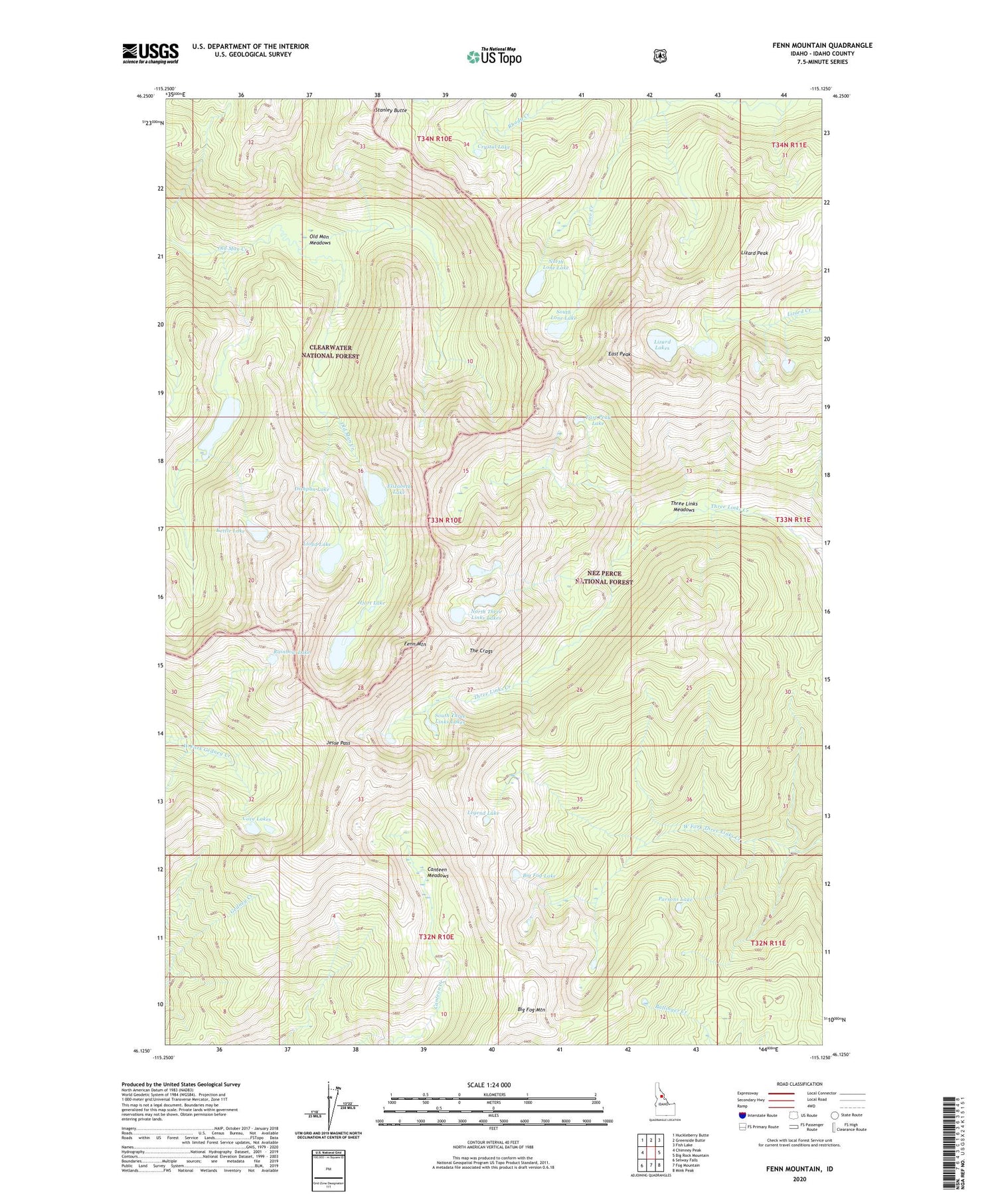
Fenn Mountain Idaho US Topo Map
Couldn't load pickup availability
Also explore the Fenn Mountain Forest Service Topo of this same quad for updated USFS data
2024 topographic map quadrangle Fenn Mountain in the state of Idaho. Scale: 1:24000. Based on the newly updated USGS 7.5' US Topo map series, this map is in the following counties: Idaho. The map contains contour data, water features, and other items you are used to seeing on USGS maps, but also has updated roads and other features. This is the next generation of topographic maps. Printed on high-quality waterproof paper with UV fade-resistant inks.
Quads adjacent to this one:
West: Chimney Peak
Northwest: Huckleberry Butte
North: Greenside Butte
Northeast: Fish Lake
East: Big Rock Mountain
Southeast: Mink Peak
South: Fog Mountain
Southwest: Selway Falls
This map covers the same area as the classic USGS quad with code o46115b2.
Contains the following named places: Big Fog Lake, Big Fog Mountain, Canteen Meadows, Cove Camp, Cove Lakes, Crystal Lake, Dishpan Lake, East Peak, East Peak Lake, Elizabeth Lake, Fenn Mountain, Florence Lake, Hjort Lake, Jesse Pass, Kettle Lake, Legend Lake, Lizard Lakes, Lizard Peak, Lloyd Lake, Lone Creek, Lone Lakes, North Lone Lake, North Three Links Lakes, Old Man Lake, Old Man Meadows, Parsons Lake, Rainbow Lake, South Lone Lake, South Three Links Lakes, Stanley Butte, The Crags, Three Links Meadows


