MyTopo
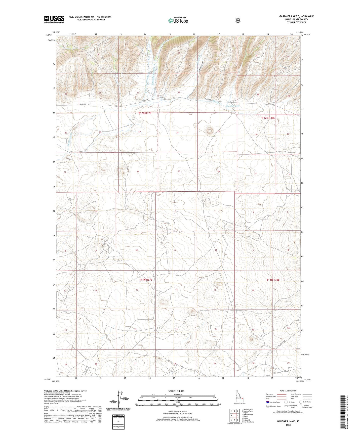
Gardner Lake Idaho US Topo Map
Couldn't load pickup availability
Also explore the Gardner Lake Forest Service Topo of this same quad for updated USFS data
2023 topographic map quadrangle Gardner Lake in the state of Idaho. Scale: 1:24000. Based on the newly updated USGS 7.5' US Topo map series, this map is in the following counties: Clark. The map contains contour data, water features, and other items you are used to seeing on USGS maps, but also has updated roads and other features. This is the next generation of topographic maps. Printed on high-quality waterproof paper with UV fade-resistant inks.
Quads adjacent to this one:
West: Spencer South
Northwest: Spencer North
North: Lookout Point
Northeast: Kilgore
East: Idmon
Southeast: Snowshoe Butte
South: Dubois NE
Southwest: Dubois
This map covers the same area as the classic USGS quad with code o44112c1.
Contains the following named places: Corral Creek, East Fork Rattlesnake Creek, Gardner Lake, Spring Creek, West Fork Rattlesnake Creek