MyTopo
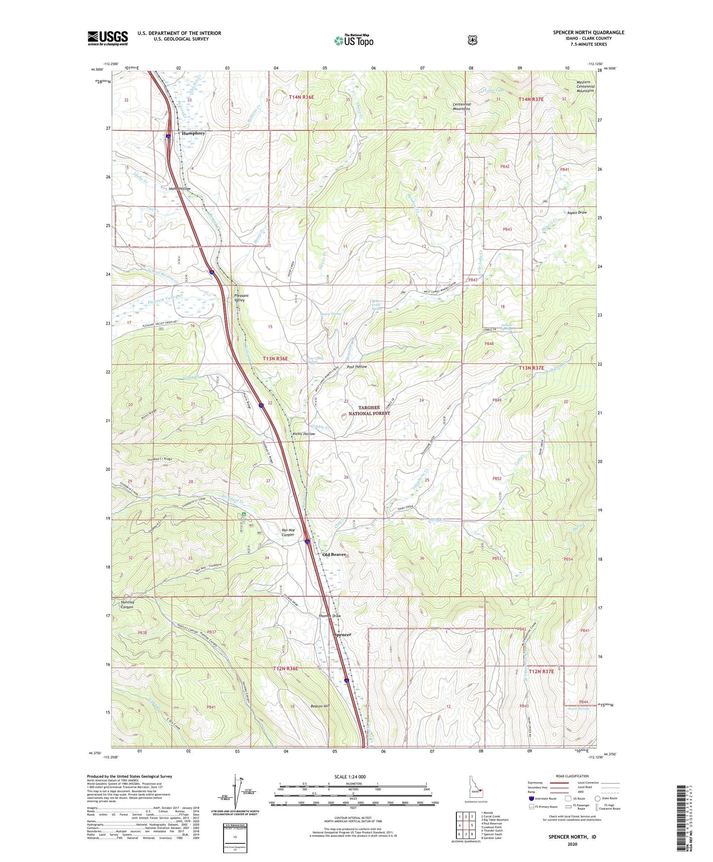
Spencer North Idaho US Topo Map
Couldn't load pickup availability
Also explore the Spencer North Forest Service Topo of this same quad for updated USFS data
2023 topographic map quadrangle Spencer North in the state of Idaho. Scale: 1:24000. Based on the newly updated USGS 7.5' US Topo map series, this map is in the following counties: Clark. The map contains contour data, water features, and other items you are used to seeing on USGS maps, but also has updated roads and other features. This is the next generation of topographic maps. Printed on high-quality waterproof paper with UV fade-resistant inks.
Quads adjacent to this one:
West: Paul Reservoir
Northwest: Monida
North: Corral Creek
Northeast: Big Table Mountain
East: Lookout Point
Southeast: Gardner Lake
South: Spencer South
Southwest: Thunder Gulch
This map covers the same area as the classic USGS quad with code o44112d2.
Contains the following named places: Aspen Draw, Beacon Hill, Beaver Creek Campground, Calf Creek, Camp Creek, Chicken Creek, Clay Creek, Cobble Creek, Cow Camp Spring, Dairy Creek, Dugway Hollow, Flat Creek, Humphrey, Huntley Canyon Trail, Idaho Creek, Idaho Hollow, Left Fork Creek, Little Lake, Little Lake Creek, Meadow Creek, Miners Creek, Miners Creek Spring, Old Beaver, Owens Creek, Owens Spring, Palmer Springs, Picnic Hollow, Pleasant Valley, Pleasant Valley Creek, Post Hollow, Robbins Creek, School Section Creek, Sheep Creek, Stoddard Creek, Stoddard Creek Campground, Sweat Springs, Telephone Creek, Thomas Draw, Van Noy Canyon, ZIP Code: 83446