MyTopo
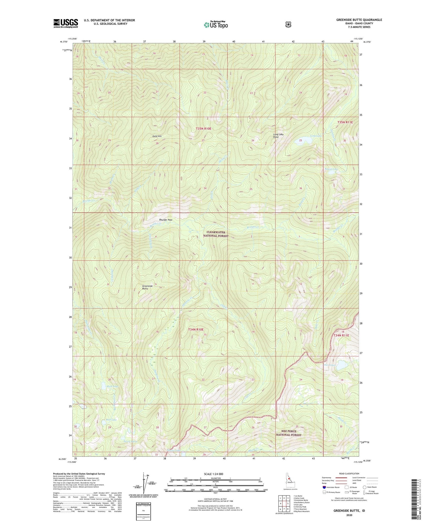
Greenside Butte Idaho US Topo Map
Couldn't load pickup availability
Also explore the Greenside Butte Forest Service Topo of this same quad for updated USFS data
2024 topographic map quadrangle Greenside Butte in the state of Idaho. Scale: 1:24000. Based on the newly updated USGS 7.5' US Topo map series, this map is in the following counties: Idaho. The map contains contour data, water features, and other items you are used to seeing on USGS maps, but also has updated roads and other features. This is the next generation of topographic maps. Printed on high-quality waterproof paper with UV fade-resistant inks.
Quads adjacent to this one:
West: Huckleberry Butte
Northwest: Liz Butte
North: Holly Creek
Northeast: Greystone Butte
East: Fish Lake
Southeast: Big Rock Mountain
South: Fenn Mountain
Southwest: Chimney Peak
This map covers the same area as the classic USGS quad with code o46115c2.
Contains the following named places: Boulder Pass, Cliff Creek, Dodo Creek, Dusty Creek, Gold Creek, Gold Hill, Greenside Butte, Heath Creek, Horse Camp, Long Lake, Long Lake Point, Mud Lake, Pell Creek, Rock Lake, Round Lake, Seven Lakes, Shady Creek, Shasta Lake, Stony Creek, Surprise Creek, Thimble Creek, Traveling Creek, Two Lakes