MyTopo
Knapp Lakes Idaho US Topo Map
Couldn't load pickup availability
Also explore the Knapp Lakes Forest Service Topo of this same quad for updated USFS data
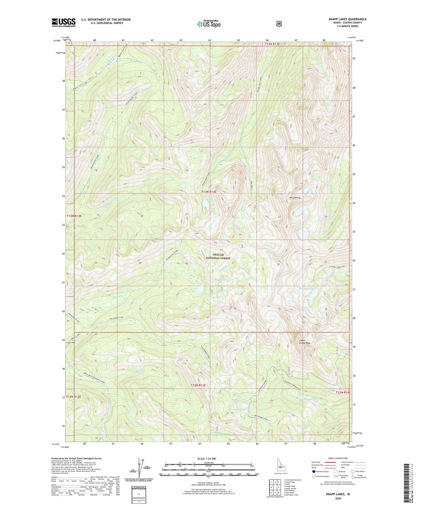
2024 topographic map quadrangle Knapp Lakes in the state of Idaho. Scale: 1:24000. Based on the newly updated USGS 7.5' US Topo map series, this map is in the following counties: Custer. The map contains contour data, water features, and other items you are used to seeing on USGS maps, but also has updated roads and other features. This is the next generation of topographic maps. Printed on high-quality waterproof paper with UV fade-resistant inks.
Quads adjacent to this one:
West: Langer Peak
Northwest: Greyhound Mountain
North: Pinyon Peak
Northeast: Casto
East: Mount Jordan
Southeast: East Basin Creek
South: Basin Butte
Southwest: Elk Meadow
This map covers the same area as the classic USGS quad with code o44114d8.
Contains the following named places: Cabin Creek Peak, Crimson Lake, Fish Lake, Hindman Lake, Horseshoe Lake, Knapp Lakes, Mount Loening, Prospect Creek, Summit Creek