MyTopo
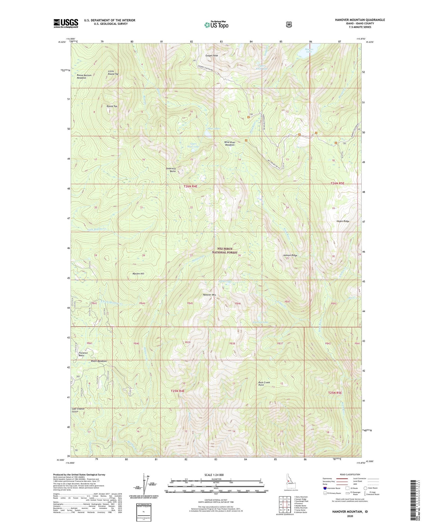
Hanover Mountain Idaho US Topo Map
Couldn't load pickup availability
Also explore the Hanover Mountain Forest Service Topo of this same quad for updated USFS data
2024 topographic map quadrangle Hanover Mountain in the state of Idaho. Scale: 1:24000. Based on the newly updated USGS 7.5' US Topo map series, this map is in the following counties: Idaho. The map contains contour data, water features, and other items you are used to seeing on USGS maps, but also has updated roads and other features. This is the next generation of topographic maps. Printed on high-quality waterproof paper with UV fade-resistant inks.
Quads adjacent to this one:
West: Florence
Northwest: Dairy Mountain
North: Sawyer Ridge
Northeast: Sourdough Peak
East: Marble Butte
Southeast: Johnson Butte
South: Carey Dome
Southwest: Kelly Mountain
This map covers the same area as the classic USGS quad with code o45115e8.
Contains the following named places: Ace Creek, Anchor Creek, Bentz Creek, Circle Creek, Emerald Lake, Gospel Peak, Grouse Creek, Hagen Ridge, Hanover Creek, Hanover Mountain, Indigo Creek, Indigo Lake, Jackson Ridge, Last Chance Gulch, Little Round Top, Marten Hill, Moores Lake, Moores Station, Moores Work Center, Rhett Meadows, Rock Creek, Rock Creek Point, Round Top, Slate Lake, Slate Lakes, Umbrella Butte, Upper Knob Lake, Upper Slate Lake, Whiskey Bills Cabin, Wilson Cow Camp, Wind River Meadows