MyTopo
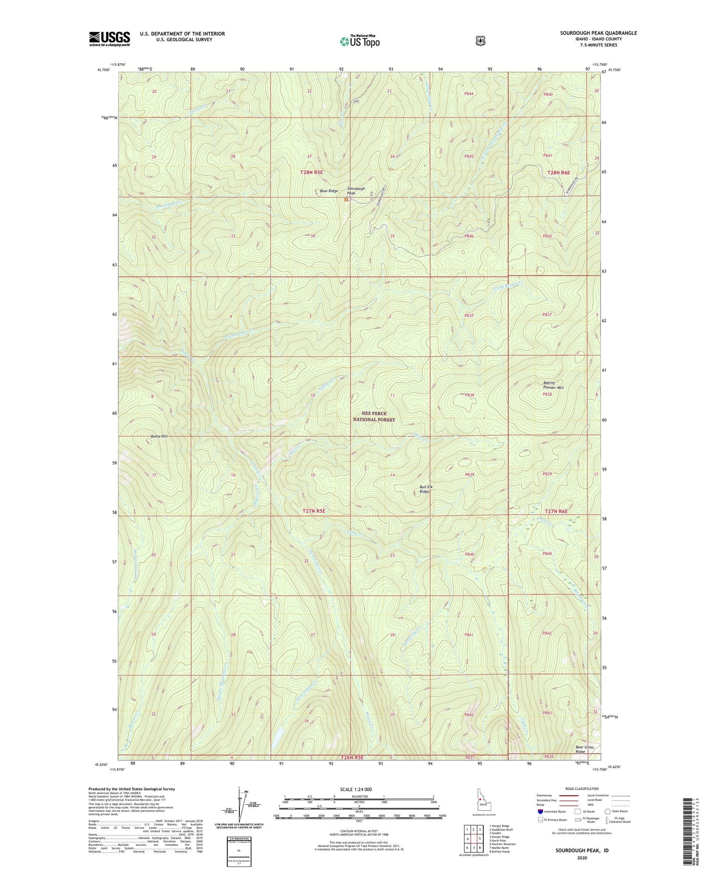
Sourdough Peak Idaho US Topo Map
Couldn't load pickup availability
Also explore the Sourdough Peak Forest Service Topo of this same quad for updated USFS data
2024 topographic map quadrangle Sourdough Peak in the state of Idaho. Scale: 1:24000. Based on the newly updated USGS 7.5' US Topo map series, this map is in the following counties: Idaho. The map contains contour data, water features, and other items you are used to seeing on USGS maps, but also has updated roads and other features. This is the next generation of topographic maps. Printed on high-quality waterproof paper with UV fade-resistant inks.
Quads adjacent to this one:
West: Sawyer Ridge
Northwest: Hungry Ridge
North: Huddleson Bluff
Northeast: Golden
East: North Pole
Southeast: Buffalo Hump
South: Marble Butte
Southwest: Hanover Mountain
This map covers the same area as the classic USGS quad with code o45115f7.
Contains the following named places: Aubion Creek, Baking Powder Mountain, Bear Grass Ridge, Blue Ridge, Boundary Creek, Bull Elk Ridge, Dome Hill, Frank Brown Creek, Hagen Creek, Kentucky Creek, Moores Creek, Open Creek, Sourdough Peak, Sourdough Saddle Campground, Square Mountain Creek, Taylor Creek, Twin Lakes, Twin Lakes Creek