MyTopo
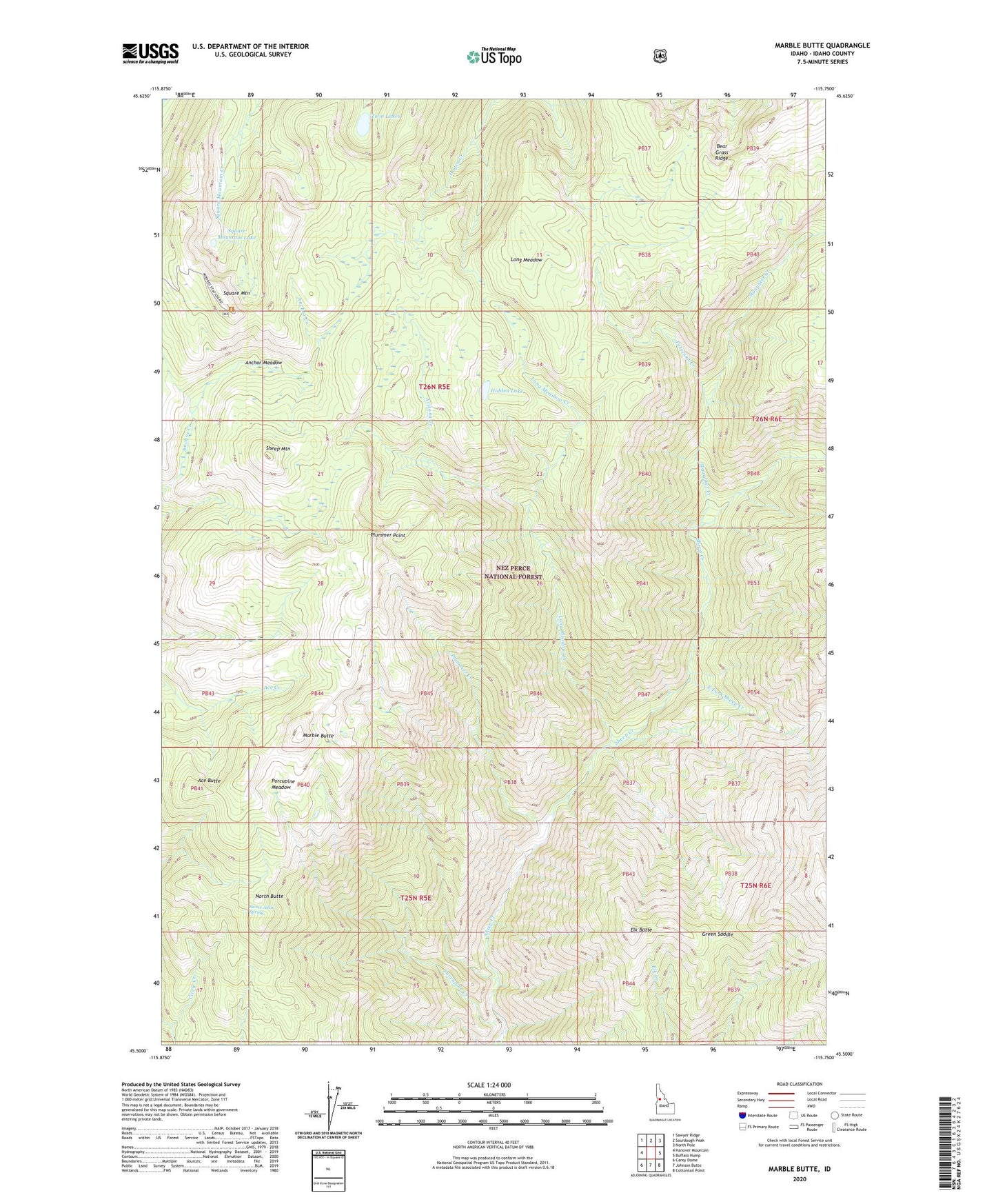
Marble Butte Idaho US Topo Map
Couldn't load pickup availability
Also explore the Marble Butte Forest Service Topo of this same quad for updated USFS data
2024 topographic map quadrangle Marble Butte in the state of Idaho. Scale: 1:24000. Based on the newly updated USGS 7.5' US Topo map series, this map is in the following counties: Idaho. The map contains contour data, water features, and other items you are used to seeing on USGS maps, but also has updated roads and other features. This is the next generation of topographic maps. Printed on high-quality waterproof paper with UV fade-resistant inks.
Quads adjacent to this one:
West: Hanover Mountain
Northwest: Sawyer Ridge
North: Sourdough Peak
Northeast: North Pole
East: Buffalo Hump
Southeast: Cottontail Point
South: Johnson Butte
Southwest: Carey Dome
This map covers the same area as the classic USGS quad with code o45115e7.
Contains the following named places: Ace Butte, Anchor Meadow, Arizona Creek, East Fork Sheep Creek, Elk Butte, Gospel-Hump Wilderness, Green Saddle, Hidden Lake, Long Meadow, Long Meadow Creek, Marble Butte, North Butte, Peterson Creek, Plummer Creek, Plummer Point, Porcupine Creek, Porcupine Meadow, Sheep Mountain, Slaughter Creek, Square Mountain, Square Mountain Lake, Sweet Anise Spring, Twin Lakes