MyTopo
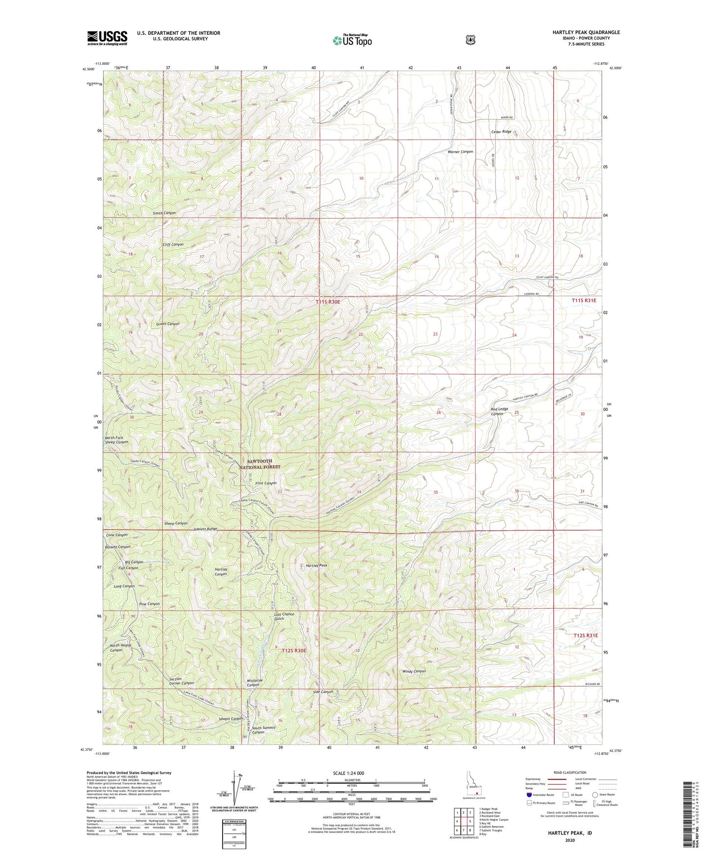
Hartley Peak Idaho US Topo Map
Couldn't load pickup availability
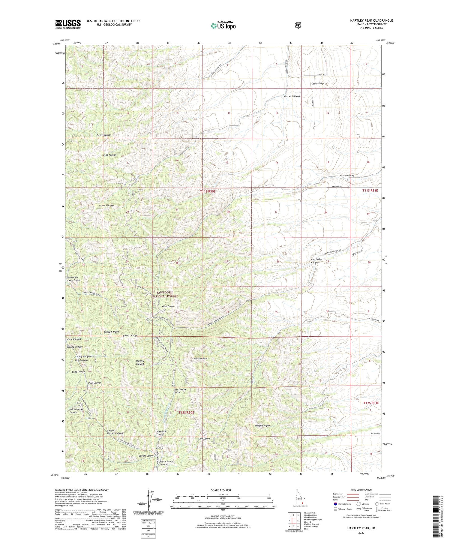
Also explore the Hartley Peak Forest Service Topo of this same quad for updated USFS data
2023 topographic map quadrangle Hartley Peak in the state of Idaho. Scale: 1:24000. Based on the newly updated USGS 7.5' US Topo map series, this map is in the following counties: Power. The map contains contour data, water features, and other items you are used to seeing on USGS maps, but also has updated roads and other features. This is the next generation of topographic maps. Printed on high-quality waterproof paper with UV fade-resistant inks.
Quads adjacent to this one:
West: North Heglar Canyon
Northwest: Badger Peak
North: Rockland West
Northeast: Rockland East
East: Roy NE
Southeast: Roy
South: Sublett Troughs
Southwest: Sublett Reservoir
This map covers the same area as the classic USGS quad with code o42112d8.
Contains the following named places: Big Canyon, Cedar Ridge, Cone Canyon, Donkey Canyon, Flat Canyon, Hartley Peak, Last Chance Gulch, Long Canyon, Mistletoe Canyon, Pine Canyon, Red Ledge Canyon, Sawpit Canyon, Section Corner Canyon, South Summit Canyon, Warner Canyon, ZIP Code: 83271