MyTopo
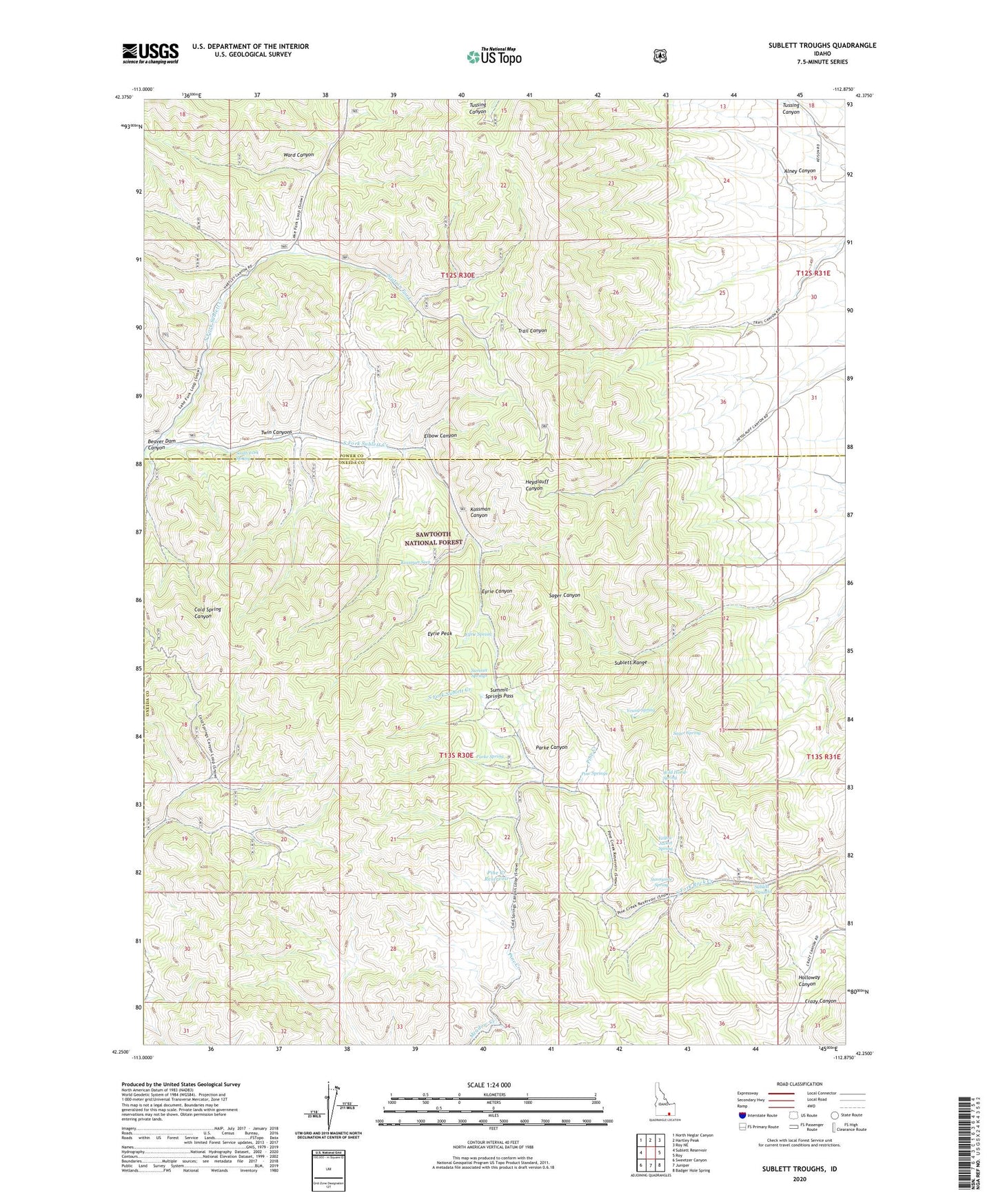
Sublett Troughs Idaho US Topo Map
Couldn't load pickup availability
Also explore the Sublett Troughs Forest Service Topo of this same quad for updated USFS data
2023 topographic map quadrangle Sublett Troughs in the state of Idaho. Scale: 1:24000. Based on the newly updated USGS 7.5' US Topo map series, this map is in the following counties: Oneida, Power. The map contains contour data, water features, and other items you are used to seeing on USGS maps, but also has updated roads and other features. This is the next generation of topographic maps. Printed on high-quality waterproof paper with UV fade-resistant inks.
Quads adjacent to this one:
West: Sublett Reservoir
Northwest: North Heglar Canyon
North: Hartley Peak
Northeast: Roy NE
East: Roy
Southeast: Badger Hole Spring
South: Juniper
Southwest: Sweetzer Canyon
This map covers the same area as the classic USGS quad with code o42112c8.
Contains the following named places: Alney Canyon, Beaver Dam Canyon, Elbow Canyon, Eyrie Canyon, Eyrie Peak, Eyrie Spring, Kossman Canyon, Kossman Seep, North Fork Sublett Creek, Parke Canyon, Parke Spring, Pine Creek, Pine Creek Reservoir, Pine Springs, Sager Spring, South Fork Spring, South Fork Sublett Creek, Station Fork, Sublett Forest Service Station, Sublett Range, Sublett Troughs, Summit Springs, Summit Springs Pass, Sunnyside Spring, Twin Canyons, Ward Canyon, Wild Horse Spring, Yellow Jacket Spring, Young Spring