MyTopo
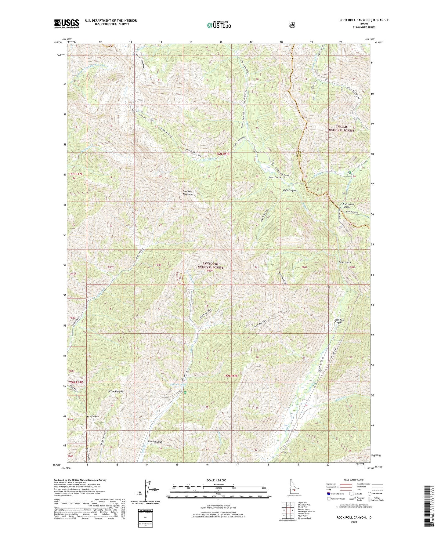
Rock Roll Canyon Idaho US Topo Map
Couldn't load pickup availability
Also explore the Rock Roll Canyon Forest Service Topo of this same quad for updated USFS data
2024 topographic map quadrangle Rock Roll Canyon in the state of Idaho. Scale: 1:24000. Based on the newly updated USGS 7.5' US Topo map series, this map is in the following counties: Blaine, Custer. The map contains contour data, water features, and other items you are used to seeing on USGS maps, but also has updated roads and other features. This is the next generation of topographic maps. Printed on high-quality waterproof paper with UV fade-resistant inks.
Quads adjacent to this one:
West: Amber Lakes
Northwest: Ryan Peak
North: Meridian Peak
Northeast: Herd Peak
East: Phi Kappa Mountain
Southeast: Hyndman Peak
South: Sun Valley
Southwest: Griffin Butte
This map covers the same area as the classic USGS quad with code o43114g3.
Contains the following named places: Basin Gulch, Cold Canyon, Lake Creek Lakes, Park Creek, Park Creek Campground, Rock Roll Canyon, Sawmill Gulch, Steep Gulch, Trail Creek Summit, West Fork Trail Creek, Wilson Creek