MyTopo
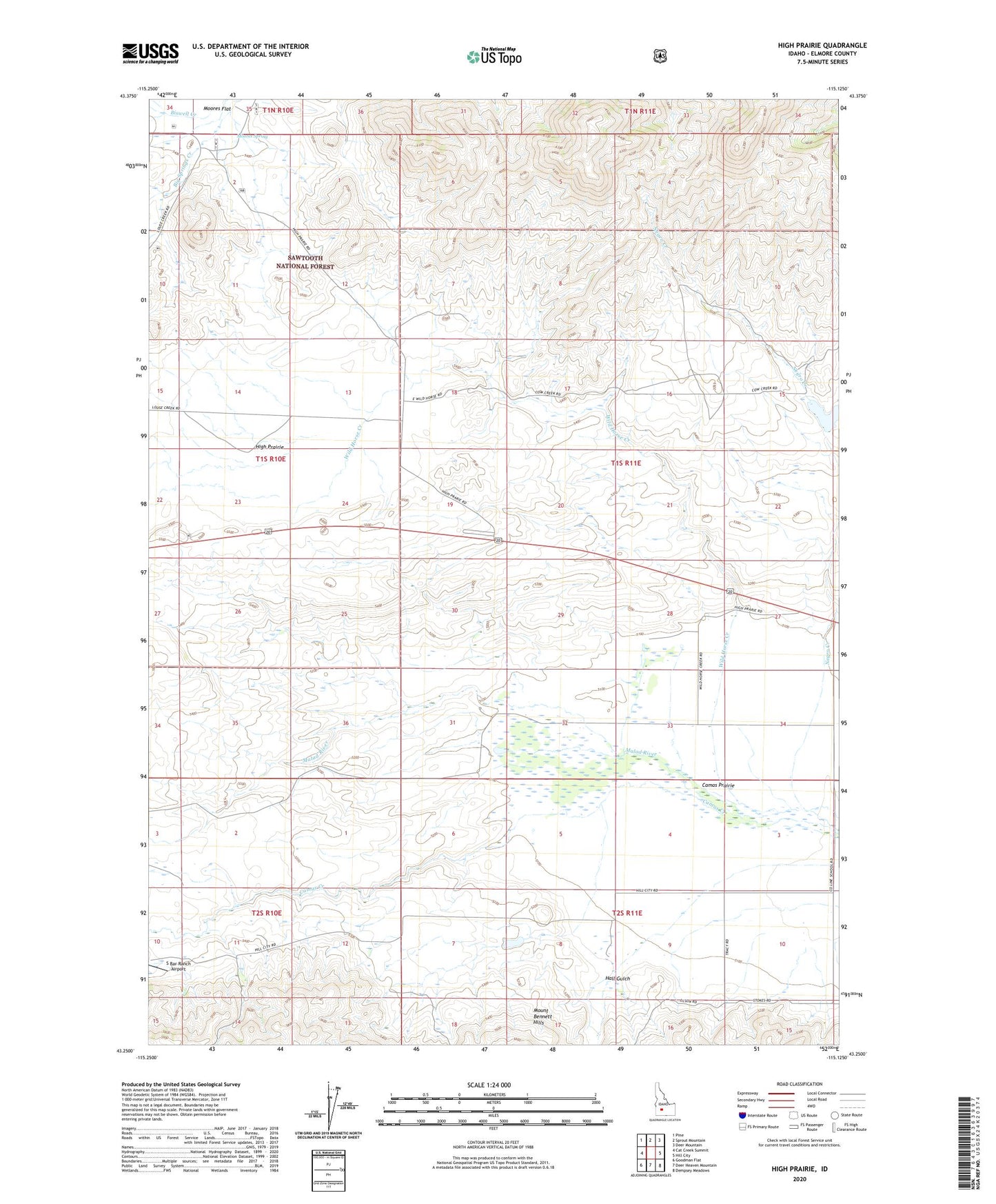
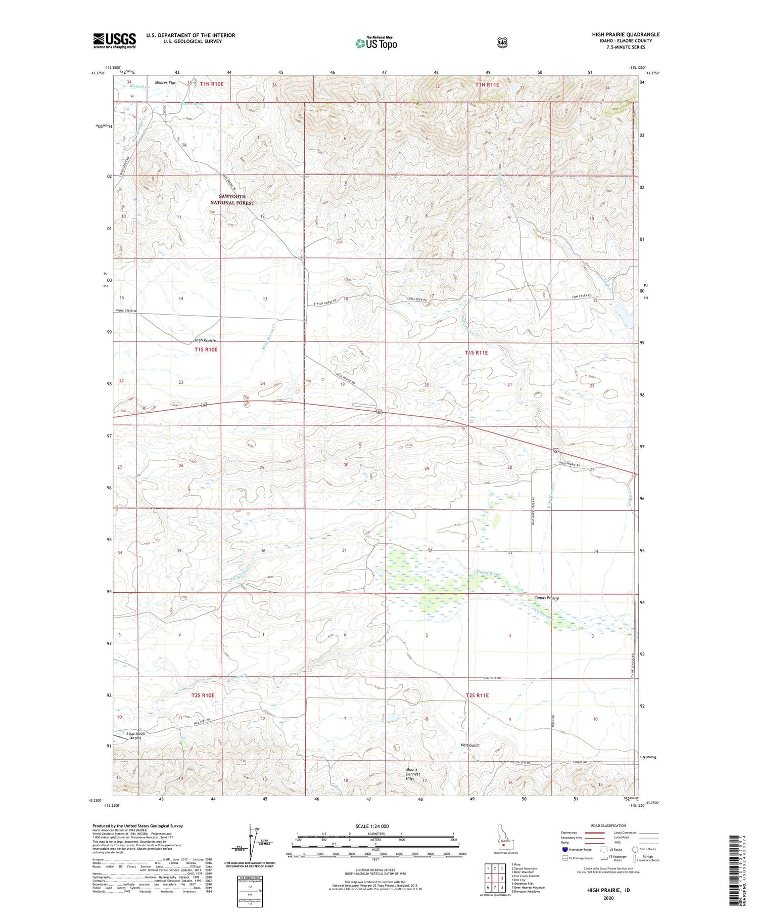
High Prairie Idaho US Topo Map
Couldn't load pickup availability
Also explore the High Prairie Forest Service Topo of this same quad for updated USFS data
2023 topographic map quadrangle High Prairie in the state of Idaho. Scale: 1:24000. Based on the newly updated USGS 7.5' US Topo map series, this map is in the following counties: Elmore. The map contains contour data, water features, and other items you are used to seeing on USGS maps, but also has updated roads and other features. This is the next generation of topographic maps. Printed on high-quality waterproof paper with UV fade-resistant inks.
Quads adjacent to this one:
West: Cat Creek Summit
Northwest: Pine
North: Sprout Mountain
Northeast: Deer Mountain
East: Hill City
Southeast: Dempsey Meadows
South: Deer Heaven Mountain
Southwest: Goodman Flat
This map covers the same area as the classic USGS quad with code o43115c2.
Contains the following named places: Biswell Creek, Francis Dam, Hall Gulch, High Prairie, Malad River, Moores Spring, Negro Creek, Olson Dam, Wild Horse Creek