MyTopo
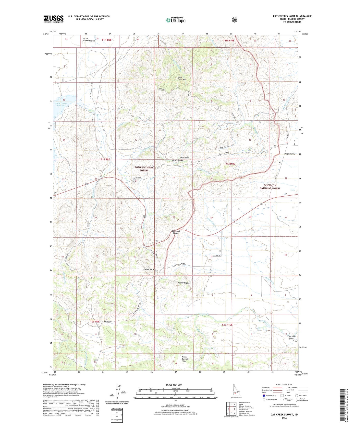
Cat Creek Summit Idaho US Topo Map
Couldn't load pickup availability
Also explore the Cat Creek Summit Forest Service Topo of this same quad for updated USFS data
2024 topographic map quadrangle Cat Creek Summit in the state of Idaho. Scale: 1:24000. Based on the newly updated USGS 7.5' US Topo map series, this map is in the following counties: Elmore. The map contains contour data, water features, and other items you are used to seeing on USGS maps, but also has updated roads and other features. This is the next generation of topographic maps. Printed on high-quality waterproof paper with UV fade-resistant inks.
Quads adjacent to this one:
West: Anderson Ranch Dam
Northwest: House Mountain
North: Pine
Northeast: Sprout Mountain
East: High Prairie
Southeast: Deer Heaven Mountain
South: Goodman Flat
Southwest: Bennett Mountain
This map covers the same area as the classic USGS quad with code o43115c3.
Contains the following named places: Buck Creek, Castle Rock Creek, Castle Rocks, Cat Creek, Cat Creek Summit, Chimney Creek, Dollar Creek, Packer Butte, S Bar Ranch Airport, Sheep Creek, Skull Rock, Soldier Mountain Game Preserve, View Point, Water Holes, Wood Creek Mountain