MyTopo
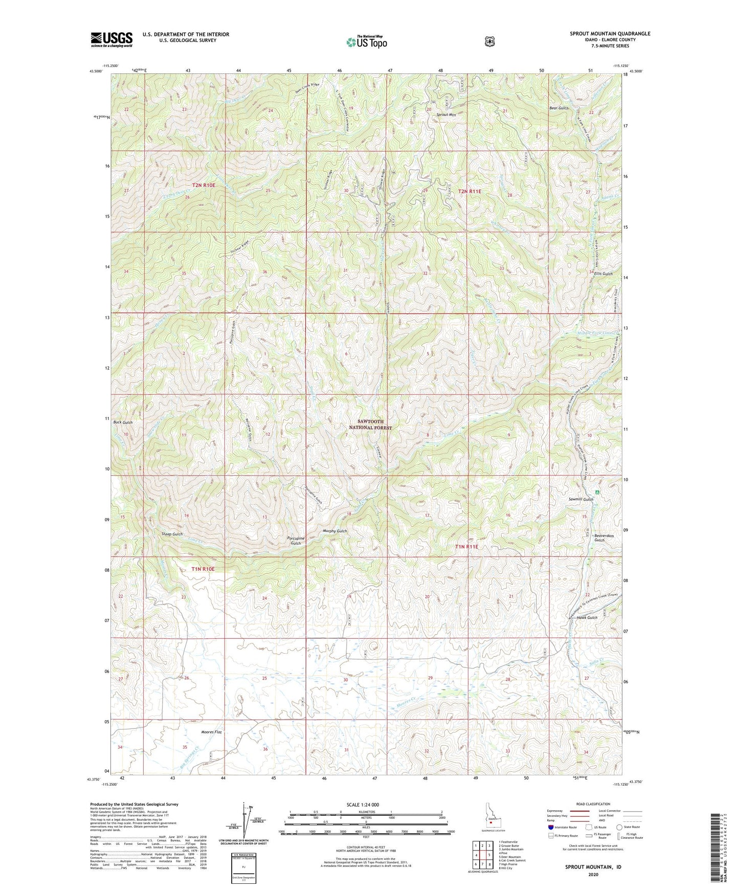
Sprout Mountain Idaho US Topo Map
Couldn't load pickup availability
Also explore the Sprout Mountain Forest Service Topo of this same quad for updated USFS data
2023 topographic map quadrangle Sprout Mountain in the state of Idaho. Scale: 1:24000. Based on the newly updated USGS 7.5' US Topo map series, this map is in the following counties: Elmore. The map contains contour data, water features, and other items you are used to seeing on USGS maps, but also has updated roads and other features. This is the next generation of topographic maps. Printed on high-quality waterproof paper with UV fade-resistant inks.
Quads adjacent to this one:
West: Pine
Northwest: Featherville
North: Grouse Butte
Northeast: Jumbo Mountain
East: Deer Mountain
Southeast: Hill City
South: High Prairie
Southwest: Cat Creek Summit
This map covers the same area as the classic USGS quad with code o43115d2.
Contains the following named places: Adams Creek, Bear Gulch, Beaverdam Gulch, Big Deer Creek, Big Springs Creek, Ellis Gulch, Hawk Gulch, Hunter Creek, Jefferson Creek, Lime Creek Campground, Little Deer Creek, Madison Creek, Middle Fork Lime Creek, Monroe Creek, Moores Creek, Moores Flat, Murphy Gulch, North Fork Lime Creek, Porcupine Gulch, Rattlesnake Creek, Salix Creek, Sawmill Gulch, Sheep Drive Trail, Slickear Creek, Snowslide Creek, South Fork Lime Creek, Sprout Creek, Sprout Mountain, Steep Gulch, Tiger Creek, Trail Creek, Whitney Creek