
MyTopo
Pine Idaho US Topo Map
Couldn't load pickup availability
Also explore the Pine Forest Service Topo of this same quad for updated USFS data
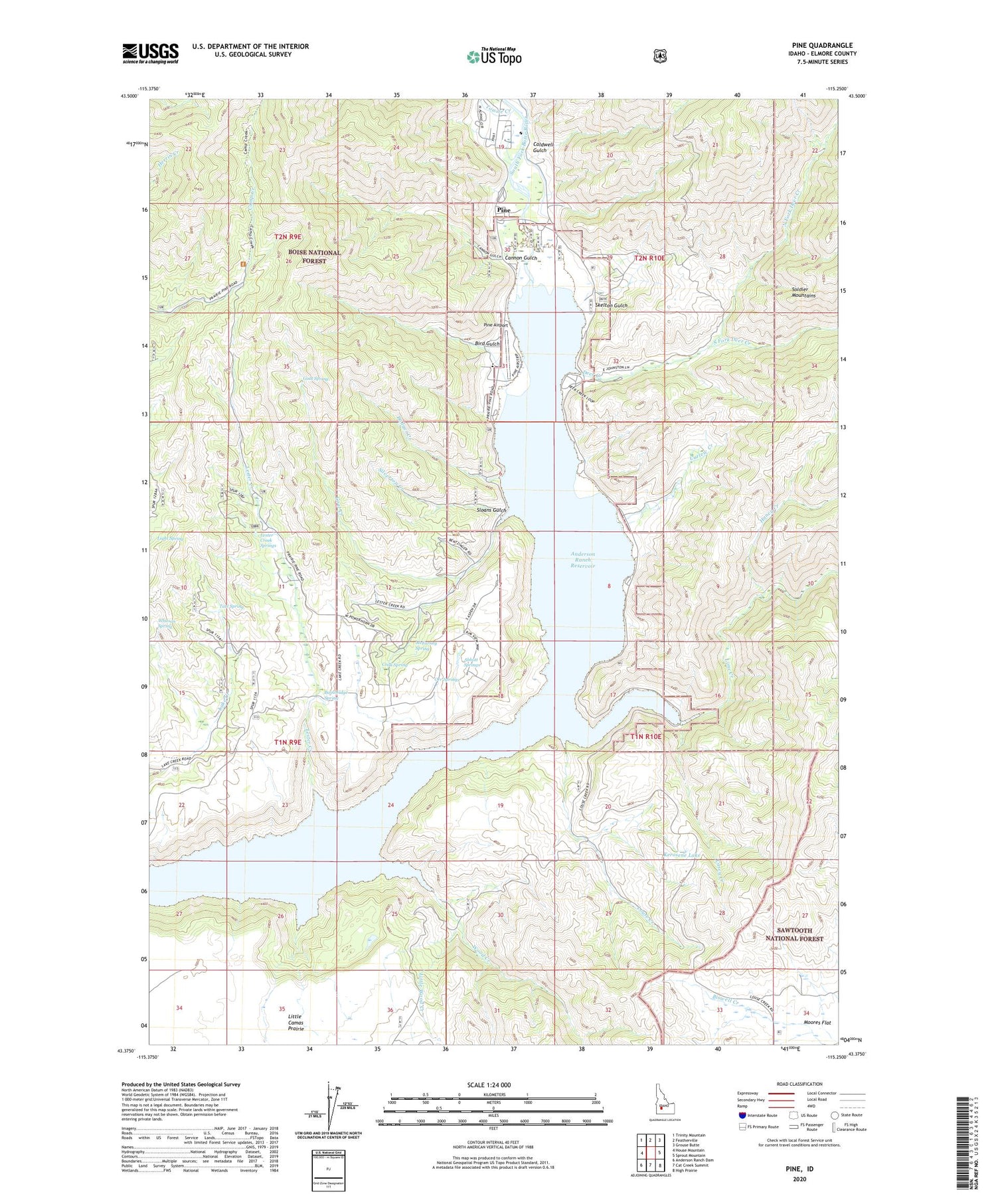
2024 topographic map quadrangle Pine in the state of Idaho. Scale: 1:24000. Based on the newly updated USGS 7.5' US Topo map series, this map is in the following counties: Elmore. The map contains contour data, water features, and other items you are used to seeing on USGS maps, but also has updated roads and other features. This is the next generation of topographic maps. Printed on high-quality waterproof paper with UV fade-resistant inks.
Quads adjacent to this one:
West: House Mountain
Northwest: Trinity Mountain
North: Featherville
Northeast: Grouse Butte
East: Sprout Mountain
Southeast: High Prairie
South: Cat Creek Summit
Southwest: Anderson Ranch Dam
This map covers the same area as the classic USGS quad with code o43115d3.
Contains the following named places: Abbott Springs, Anderson Ranch Big Game Range, Anderson Ranch Reservoir, Badger Creek, Bainbridge Spring, Bird Gulch, Buck Gulch, Caldwell Gulch, Cannon Gulch, Casey Creek, Cook Spring, Curlew Creek, Curlew Creek Recreation Site, Deer Creek, Deer Creek Boat Ramp, Franklin Mine, Goat Creek, Goat Spring, Honey Creek, Idaho State Highway Maintenance Station, Kerosene Lake, Lester Creek, Lester Creek Forest Service Station, Lester Creek Springs, Light Spring, Lime Creek, Little Wood Creek, Louse Creek, McFarney Spring, North Fork Deer Creek, Orr Springs, Pine, Pine Airport, Pine AIrport Boat Ramp, Pine Cemetery, Pine Post Office, Pine Recreation Site, Silverton Creek, Skelton Gulch, Sloans Gulch, South Fork Deer Creek, Tate Spring, Towne Creek, Whitson Spring, Wood Creek


