MyTopo
Homer Valley Idaho US Topo Map
Couldn't load pickup availability
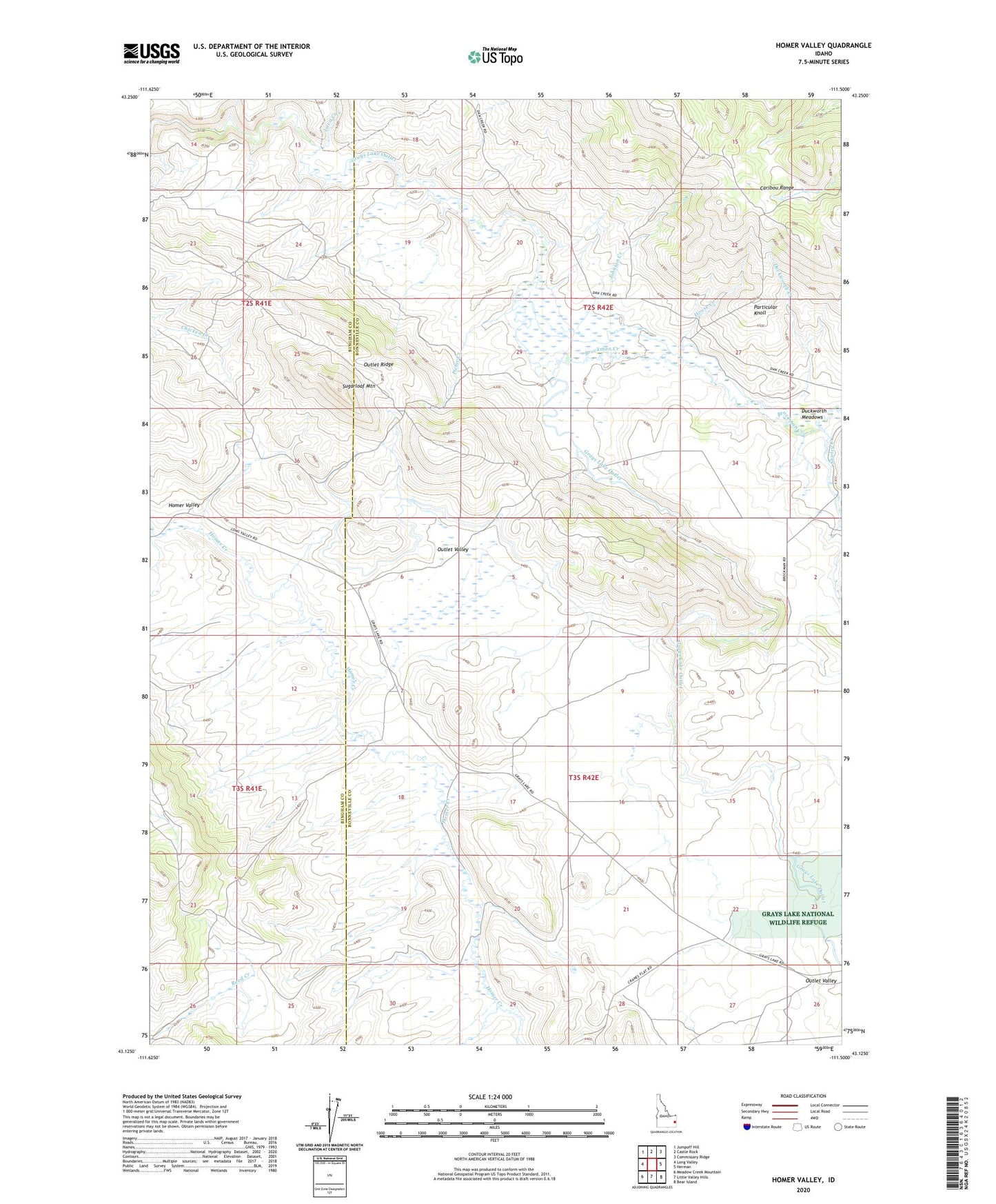
2024 topographic map quadrangle Homer Valley in the state of Idaho. Scale: 1:24000. Based on the newly updated USGS 7.5' US Topo map series, this map is in the following counties: Bonneville, Bingham. The map contains contour data, water features, and other items you are used to seeing on USGS maps, but also has updated roads and other features. This is the next generation of topographic maps. Printed on high-quality waterproof paper with UV fade-resistant inks.
Quads adjacent to this one:
West: Long Valley
Northwest: Jumpoff Hill
North: Castle Rock
Northeast: Commissary Ridge
East: Herman
Southeast: Bear Island
South: Little Valley Hills
Southwest: Meadow Creek Mountain
This map covers the same area as the classic USGS quad with code o43111b5.
Contains the following named places: Brockman Creek, Duckworth Creek, Duckworth Meadows, Grays Creek Outlet Access Area, Homer Valley, House Creek, Johnson Creek, Lava Creek, Outlet Ridge, Outlet Valley, Particular Knoll, Picnic Creek, Shirley Creek, Sugarloaf Mountain