MyTopo
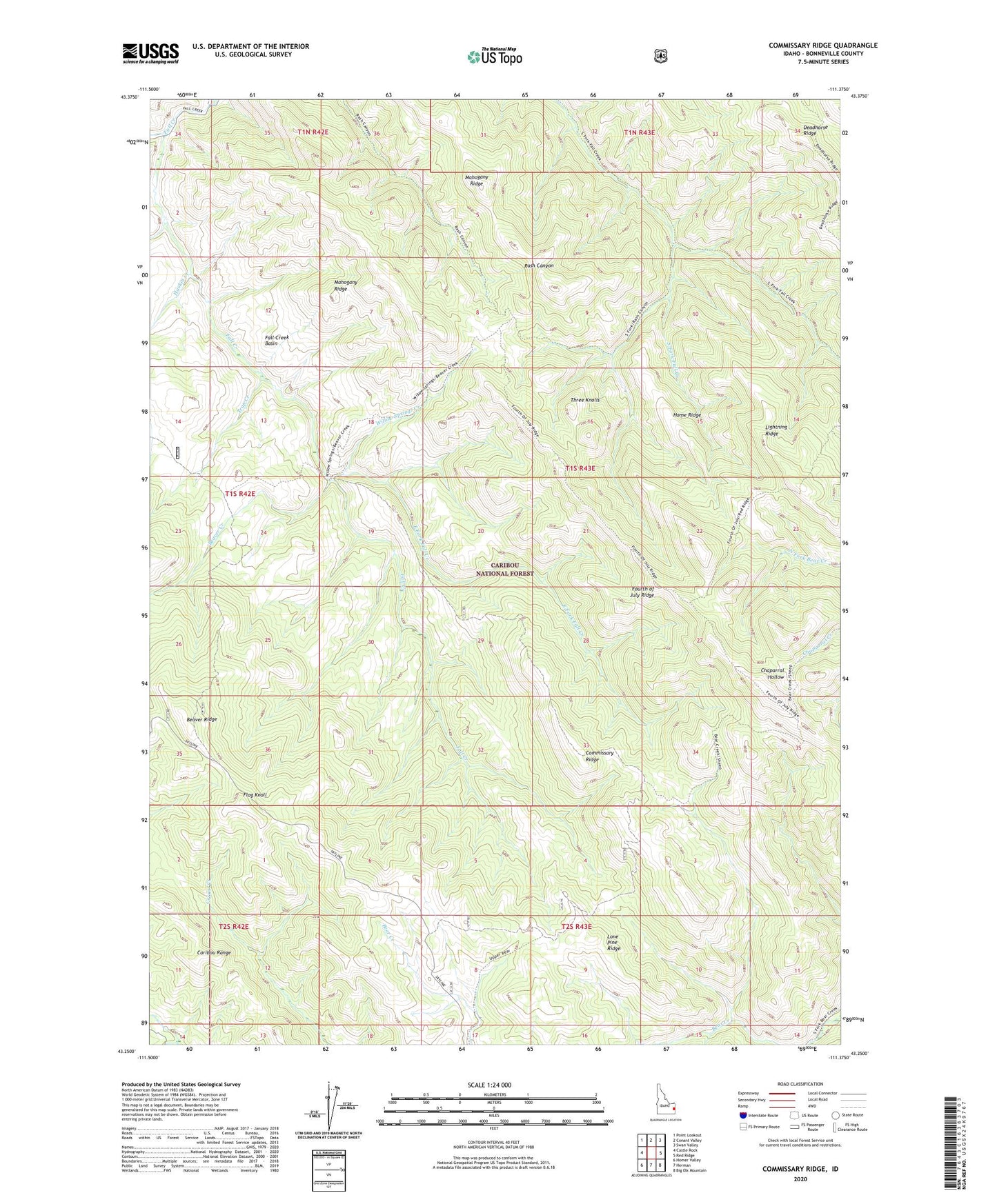
Commissary Ridge Idaho US Topo Map
Couldn't load pickup availability
Also explore the Commissary Ridge Forest Service Topo of this same quad for updated USFS data
2024 topographic map quadrangle Commissary Ridge in the state of Idaho. Scale: 1:24000. Based on the newly updated USGS 7.5' US Topo map series, this map is in the following counties: Bonneville. The map contains contour data, water features, and other items you are used to seeing on USGS maps, but also has updated roads and other features. This is the next generation of topographic maps. Printed on high-quality waterproof paper with UV fade-resistant inks.
Quads adjacent to this one:
West: Castle Rock
Northwest: Point Lookout
North: Conant Valley
Northeast: Swan Valley
East: Red Ridge
Southeast: Big Elk Mountain
South: Herman
Southwest: Homer Valley
This map covers the same area as the classic USGS quad with code o43111c4.
Contains the following named places: Beaver Creek, Beaver Ridge, Camp Creek, Commissary Ridge, East Fork Fall Creek, Fall Creek Basin, Flag Knoll, Fourth of July Ridge, Gibson Creek, Haskin Creek, Home Ridge, Lightning Ridge, Lone Pine Ridge, Mahogany Ridge, Swan Valley Division, Three Knolls, Trap Creek, Willow Springs Creek, ZIP Code: 83449