MyTopo
Meadow Creek Mountain Idaho US Topo Map
Couldn't load pickup availability
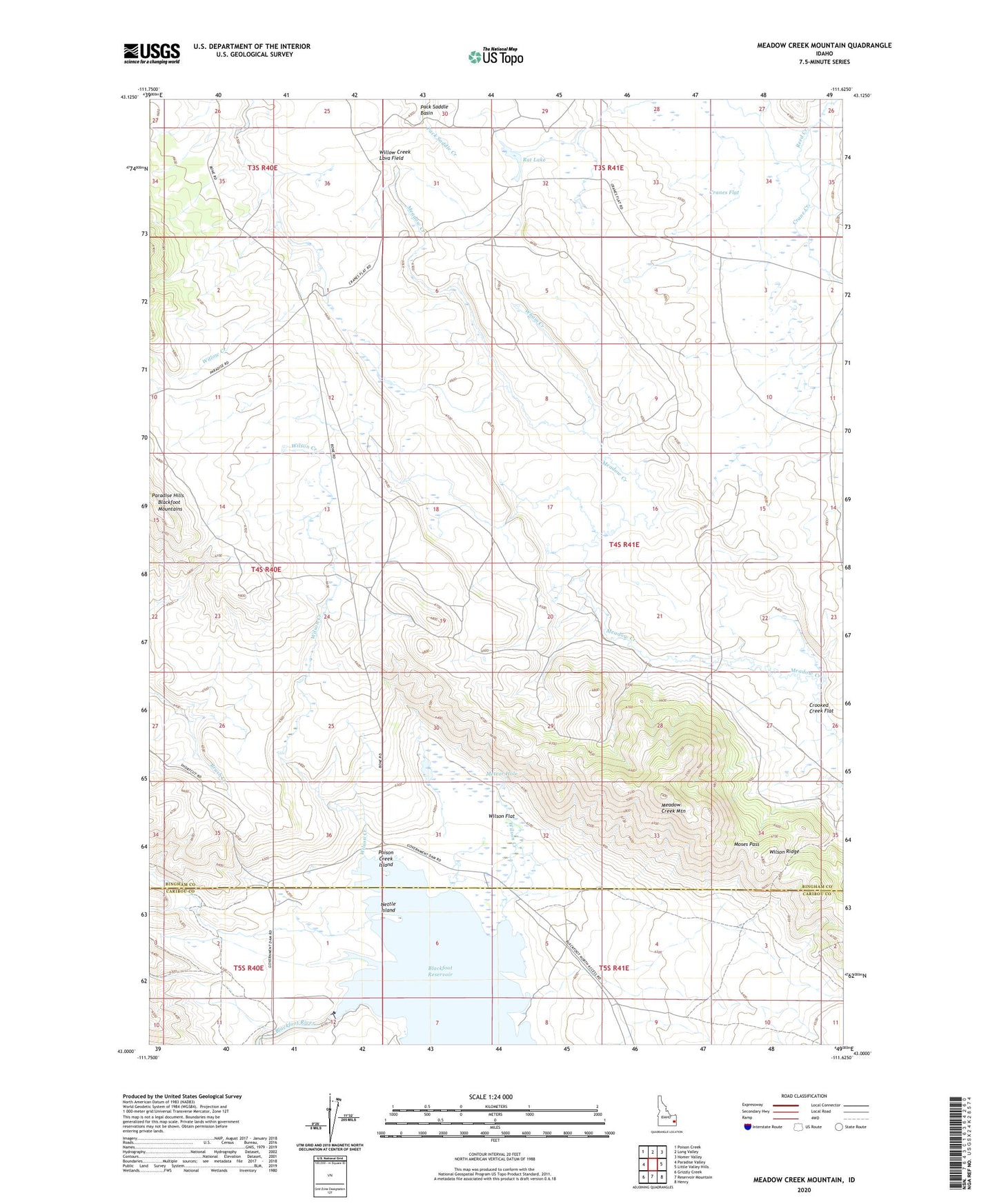
2024 topographic map quadrangle Meadow Creek Mountain in the state of Idaho. Scale: 1:24000. Based on the newly updated USGS 7.5' US Topo map series, this map is in the following counties: Bingham, Caribou. The map contains contour data, water features, and other items you are used to seeing on USGS maps, but also has updated roads and other features. This is the next generation of topographic maps. Printed on high-quality waterproof paper with UV fade-resistant inks.
Quads adjacent to this one:
West: Paradise Valley
Northwest: Poison Creek
North: Long Valley
Northeast: Homer Valley
East: Little Valley Hills
Southeast: Henry
South: Reservoir Mountain
Southwest: Grizzly Creek
This map covers the same area as the classic USGS quad with code o43111a6.
Contains the following named places: Association Corral, Blackfoot Dam, Cranes Flat, Four Corners, Hansen Corral, Meadow Creek Mountain, Meteor Hole, Moses Pass, Nettle Island, Poison Creek, Poison Creek Boat Ramp, Poison Creek Island, Rat Lake, Reed Creek, Wham Creek, Wilson Creek, Wilson Flat, Wilson Ridge