MyTopo
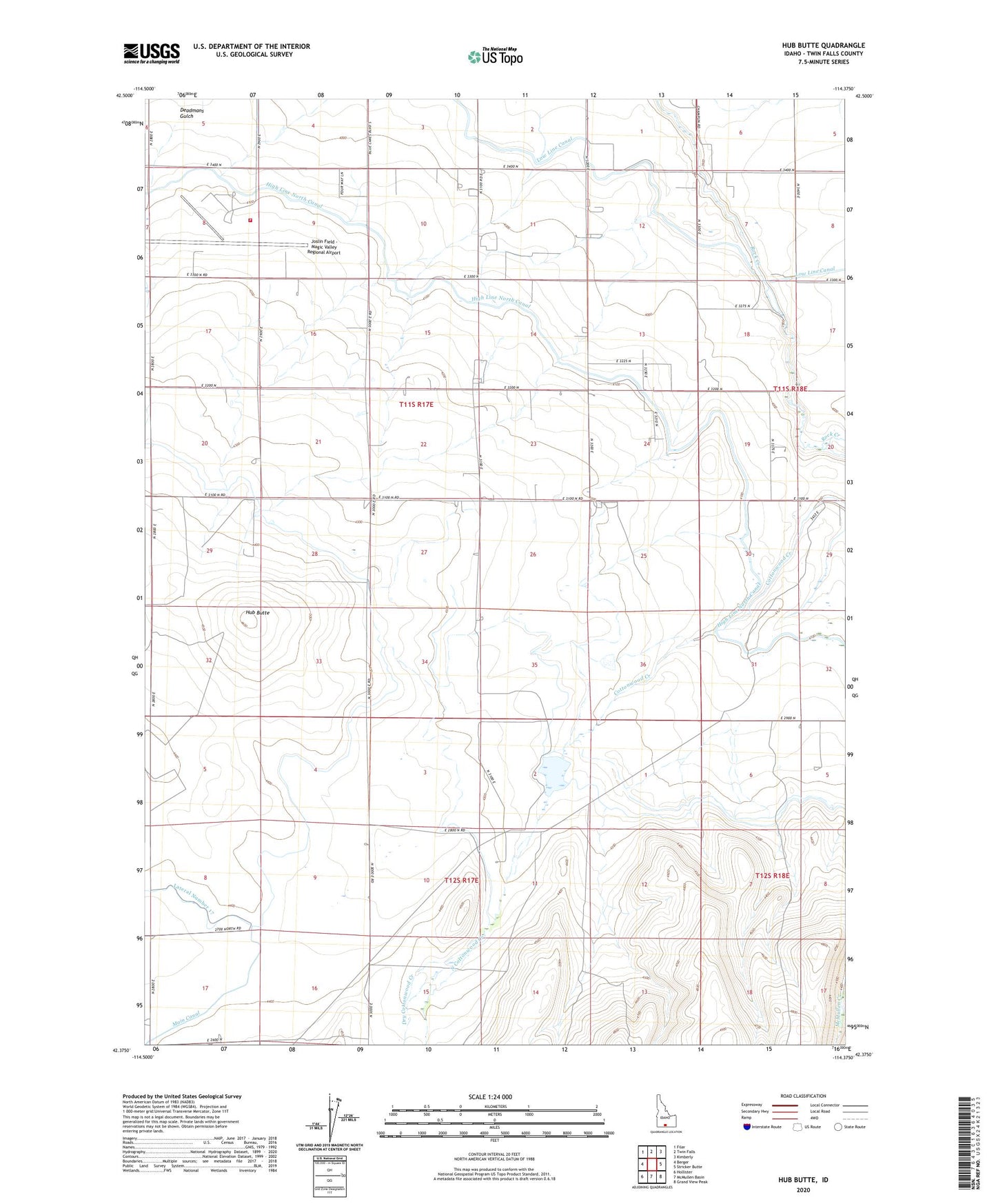
Hub Butte Idaho US Topo Map
Couldn't load pickup availability
2023 topographic map quadrangle Hub Butte in the state of Idaho. Scale: 1:24000. Based on the newly updated USGS 7.5' US Topo map series, this map is in the following counties: Twin Falls. The map contains contour data, water features, and other items you are used to seeing on USGS maps, but also has updated roads and other features. This is the next generation of topographic maps. Printed on high-quality waterproof paper with UV fade-resistant inks.
Quads adjacent to this one:
West: Berger
Northwest: Filer
North: Twin Falls
Northeast: Kimberly
East: Stricker Butte
Southeast: Grand View Peak
South: McMullen Basin
Southwest: Hollister
This map covers the same area as the classic USGS quad with code o42114d4.
Contains the following named places: Canyonview Farm, Cottonwood Creek, Deadmans Gulch, Dry Cottonwood Creek, Hub Butte, Joslin Field - Magic Valley Regional Airport, McMullen Creek Dam, North Cottonwood Creek, Twin Falls Fire Department Station 4