MyTopo
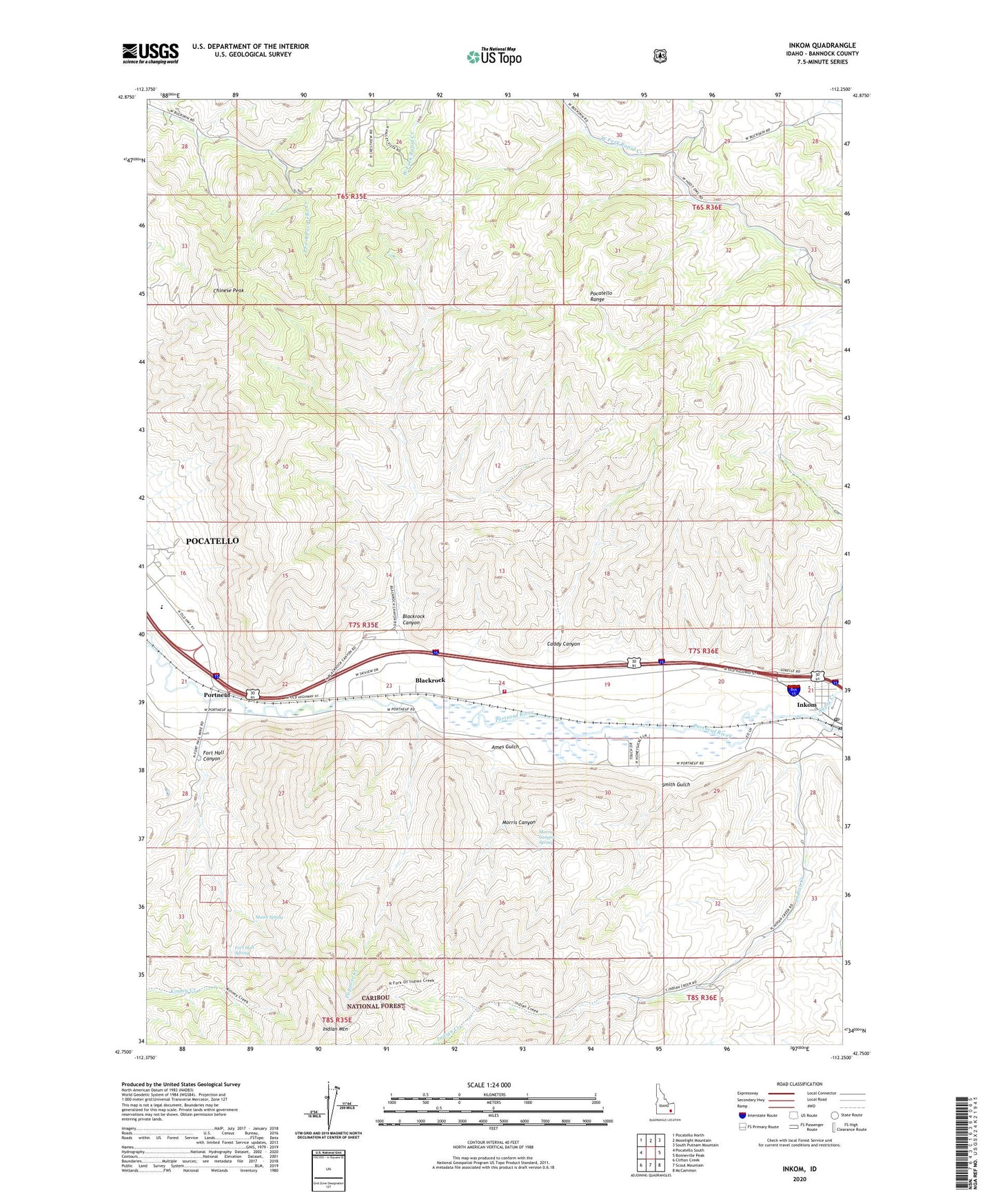
Inkom Idaho US Topo Map
Couldn't load pickup availability
Also explore the Inkom Forest Service Topo of this same quad for updated USFS data
2023 topographic map quadrangle Inkom in the state of Idaho. Scale: 1:24000. Based on the newly updated USGS 7.5' US Topo map series, this map is in the following counties: Bannock. The map contains contour data, water features, and other items you are used to seeing on USGS maps, but also has updated roads and other features. This is the next generation of topographic maps. Printed on high-quality waterproof paper with UV fade-resistant inks.
Quads adjacent to this one:
West: Pocatello South
Northwest: Pocatello North
North: Moonlight Mountain
Northeast: South Putnam Mountain
East: Bonneville Peak
Southeast: McCammon
South: Scout Mountain
Southwest: Clifton Creek
This map covers the same area as the classic USGS quad with code o42112g3.
Contains the following named places: Ames Gulch, Blackrock, Blackrock Canyon, Caddy Canyon, Caribou Ski Area, Chinese Peak, City of Inkom, Fort Hall Canyon, Fort Hall Mine, Fort Hall Spring, Indian Creek, Inkom, Inkom Division, Inkom Elementary School, Inkom Post Office, Marsh Creek, Mink Creek, Morris Canyon, Morris Canyon Spring, Munn Spring, Papoose Creek, Pocatello Valley Fire Department Station 1, Portneuf, Portneuf River Slough, Rapid Creek, Silver Sage Girl Scout Camp, Smith Gulch