MyTopo
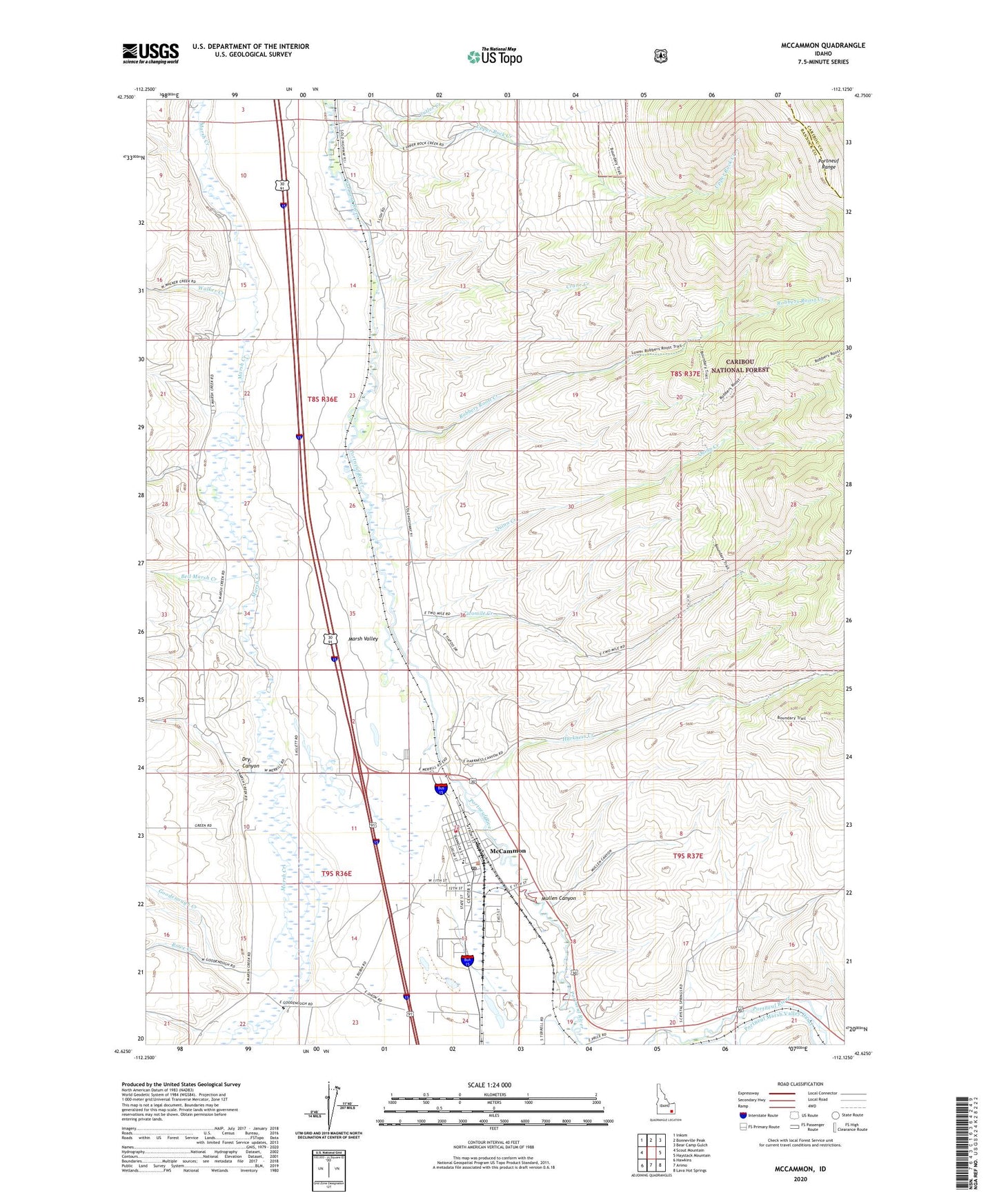
McCammon Idaho US Topo Map
Couldn't load pickup availability
Also explore the McCammon Forest Service Topo of this same quad for updated USFS data
2023 topographic map quadrangle McCammon in the state of Idaho. Scale: 1:24000. Based on the newly updated USGS 7.5' US Topo map series, this map is in the following counties: Bannock, Caribou. The map contains contour data, water features, and other items you are used to seeing on USGS maps, but also has updated roads and other features. This is the next generation of topographic maps. Printed on high-quality waterproof paper with UV fade-resistant inks.
Quads adjacent to this one:
West: Scout Mountain
Northwest: Inkom
North: Bonneville Peak
Northeast: Bear Camp Gulch
East: Haystack Mountain
Southeast: Lava Hot Springs
South: Arimo
Southwest: Hawkins
This map covers the same area as the classic USGS quad with code o42112f2.
Contains the following named places: Bannock County, Bell Marsh Creek, City of McCammon, Crane Creek, Dry Canyon, Goodenough Creek, Harkness Creek, Indian Rocks State Park, McCammon, McCammon Post Office, McCammon Volunteer Fire Department, Mountain View Elementary School, Mullen Canyon, Onyx, Portneuf Wildlife Management Area, Quinn Creek, Robbers Roost Creek, Rowe Creek, Twomile Creek, Upper Rock Creek, Walker Creek, ZIP Code: 83250