MyTopo
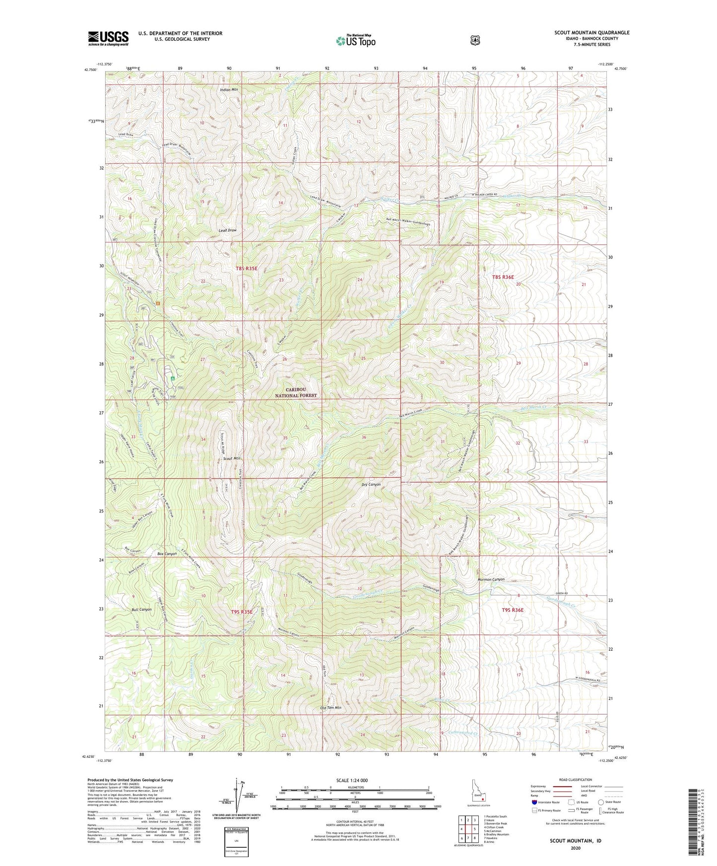
Scout Mountain Idaho US Topo Map
Couldn't load pickup availability
Also explore the Scout Mountain Forest Service Topo of this same quad for updated USFS data
2023 topographic map quadrangle Scout Mountain in the state of Idaho. Scale: 1:24000. Based on the newly updated USGS 7.5' US Topo map series, this map is in the following counties: Bannock. The map contains contour data, water features, and other items you are used to seeing on USGS maps, but also has updated roads and other features. This is the next generation of topographic maps. Printed on high-quality waterproof paper with UV fade-resistant inks.
Quads adjacent to this one:
West: Clifton Creek
Northwest: Pocatello South
North: Inkom
Northeast: Bonneville Peak
East: McCammon
Southeast: Arimo
South: Hawkins
Southwest: Bradley Mountain
Contains the following named places: Big Fir Picnic Area, Camp Tendoy, Indian Mountain, Mormon Canyon, Scout Mountain, Scout Mountain Campground, South Fork Walker Creek