MyTopo
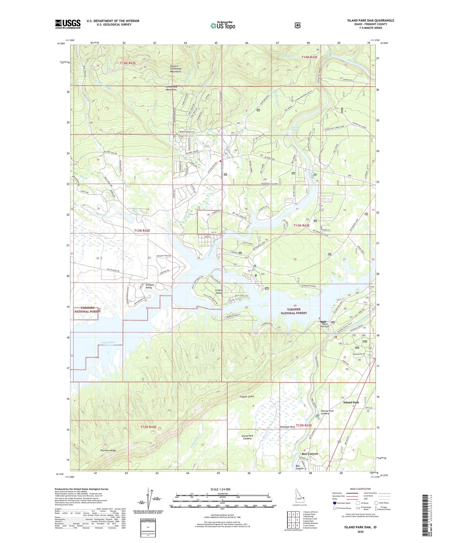
Island Park Dam Idaho US Topo Map
Couldn't load pickup availability
Also explore the Island Park Dam Forest Service Topo of this same quad for updated USFS data
2024 topographic map quadrangle Island Park Dam in the state of Idaho. Scale: 1:24000. Based on the newly updated USGS 7.5' US Topo map series, this map is in the following counties: Fremont. The map contains contour data, water features, and other items you are used to seeing on USGS maps, but also has updated roads and other features. This is the next generation of topographic maps. Printed on high-quality waterproof paper with UV fade-resistant inks.
Quads adjacent to this one:
West: Icehouse Creek
Northwest: Mount Jefferson
North: Sawtell Peak
Northeast: Big Springs
East: Island Park
Southeast: Hatchery Butte
South: Last Chance
Southwest: Bishop Mountain
This map covers the same area as the classic USGS quad with code o44111d4.
Contains the following named places: Antelope Park, Arange Creek, Blind Creek, Blue Creek, Box Canyon, Buffalo River, Buttermilk Campground, Coffee Pot Creek, Coffee Pot Rapids, Crow Creek, Dry Creek, East Fork Hotel Creek, Elk Springs Creek, Harrison Spring, Hotel Creek, I P Bills Island, Island Park Dam, Island Park Fire Department Station 3, Jackson Landing Campground, Lower Coffee Pot Campground, McCrea Bridge Campground, McCrea Ranch, Mill Creek, Mill Creek Campground, Rea, Sheep Creek, Shotgun Valley, Tyler Creek, West Fork Hotel Creek, West Fork Mill Creek, Yale Creek, ZIP Code: 83429