MyTopo
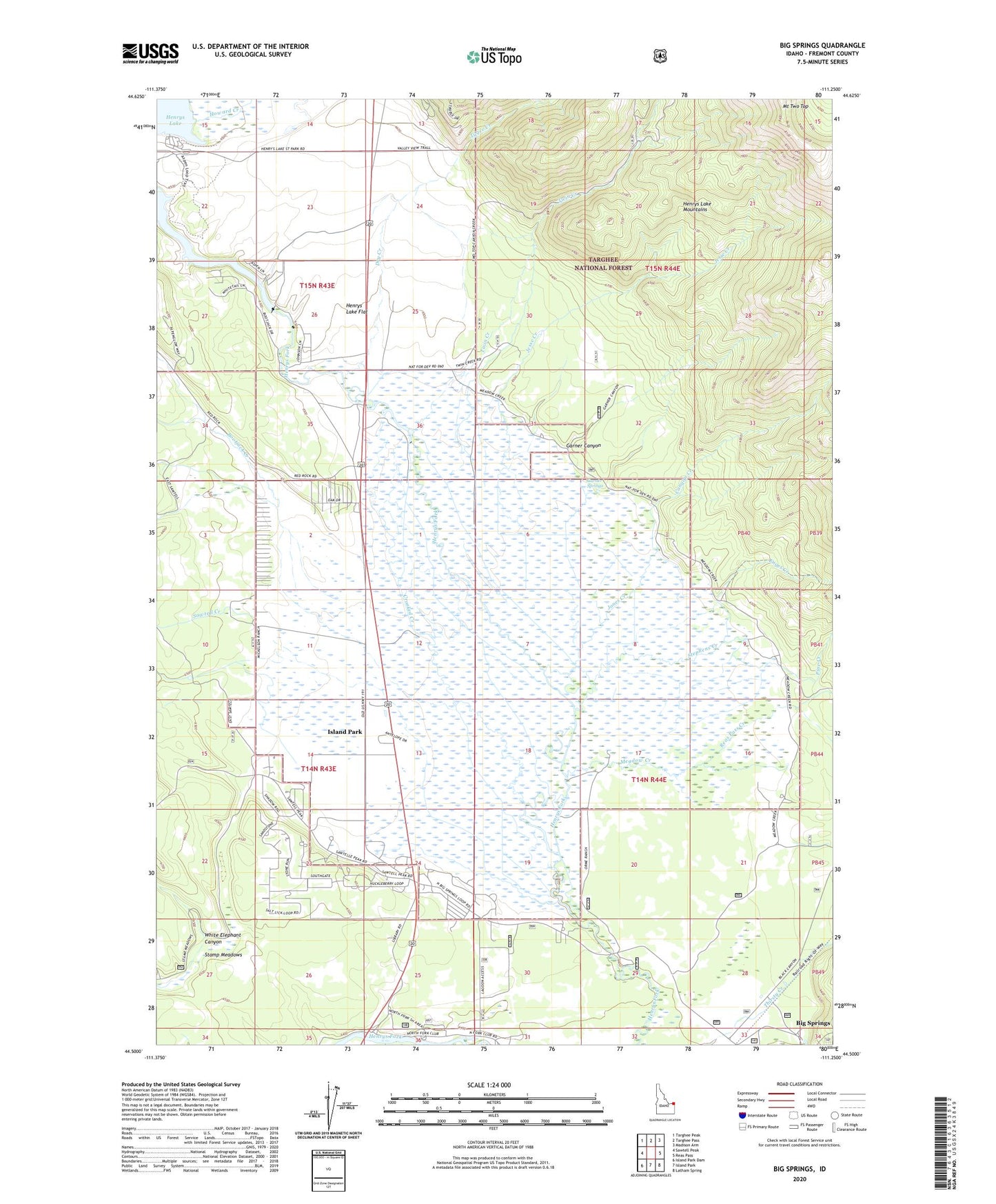
Big Springs Idaho US Topo Map
Couldn't load pickup availability
Also explore the Big Springs Forest Service Topo of this same quad for updated USFS data
2024 topographic map quadrangle Big Springs in the state of Idaho. Scale: 1:24000. Based on the newly updated USGS 7.5' US Topo map series, this map is in the following counties: Fremont. The map contains contour data, water features, and other items you are used to seeing on USGS maps, but also has updated roads and other features. This is the next generation of topographic maps. Printed on high-quality waterproof paper with UV fade-resistant inks.
Quads adjacent to this one:
West: Sawtell Peak
Northwest: Targhee Peak
North: Targhee Pass
Northeast: Madison Arm
East: Reas Pass
Southeast: Latham Spring
South: Island Park
Southwest: Island Park Dam
This map covers the same area as the classic USGS quad with code o44111e3.
Contains the following named places: Bootjack Creek, Canyon Creek, Crooked Creek, Dry Creek, Enget Creek, Flat Rock, Garner Canyon, Garner Springs, Henrys Lake Dam, Henrys Lake Flat, Henrys Lake State Park, Howard Creek, Island Park Golf Course, Jesse Creek, Jones Creek, Meadow Creek, Mount Two Top, Pine Creek, Reas Pass Creek, Sawtell Creek, Stamp Meadows, Stephens Creek, Twin Creek, Tygee Creek, White Elephant Canyon