MyTopo
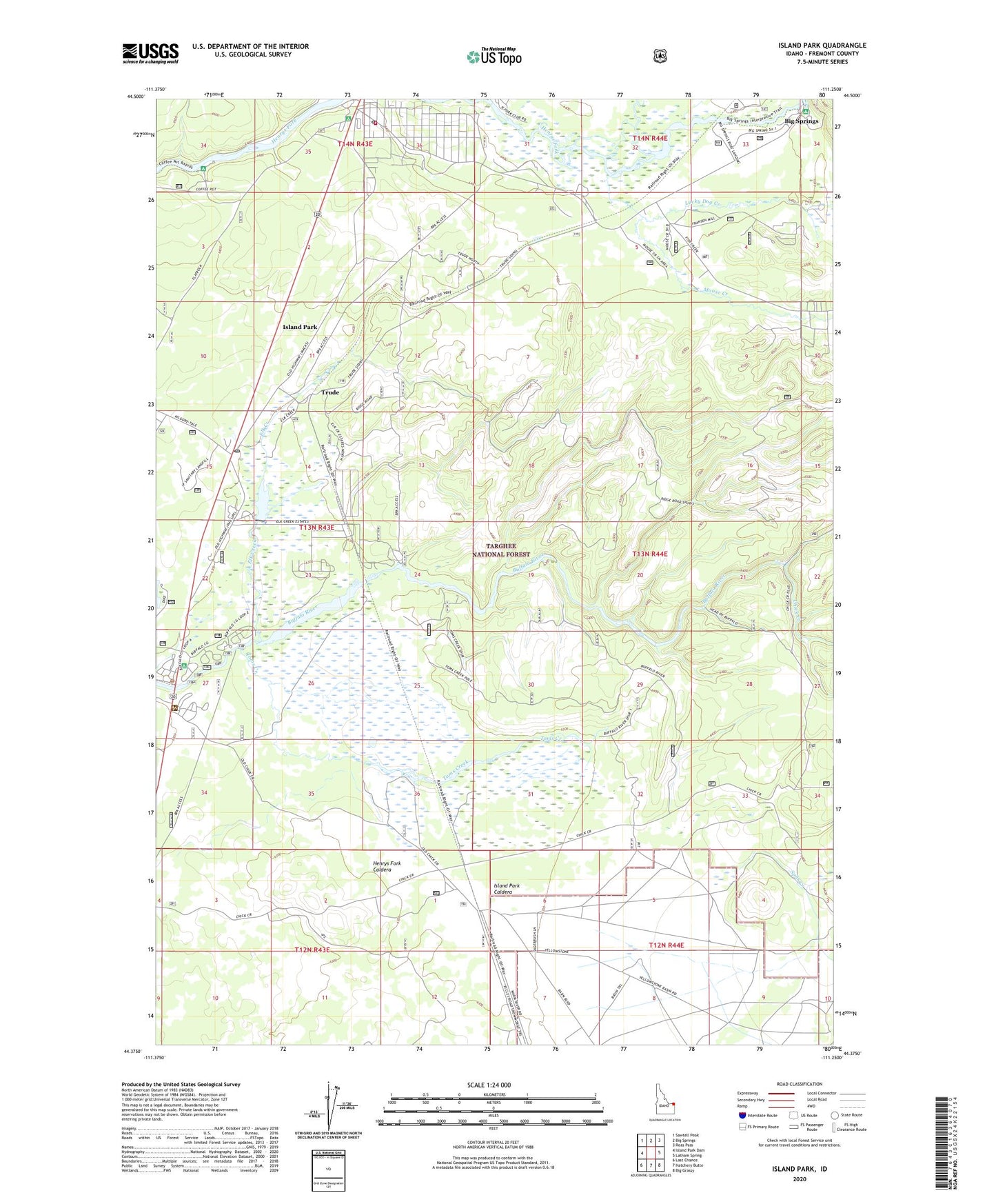
Island Park Idaho US Topo Map
Couldn't load pickup availability
Also explore the Island Park Forest Service Topo of this same quad for updated USFS data
2023 topographic map quadrangle Island Park in the state of Idaho. Scale: 1:24000. Based on the newly updated USGS 7.5' US Topo map series, this map is in the following counties: Fremont. The map contains contour data, water features, and other items you are used to seeing on USGS maps, but also has updated roads and other features. This is the next generation of topographic maps. Printed on high-quality waterproof paper with UV fade-resistant inks.
Quads adjacent to this one:
West: Island Park Dam
Northwest: Sawtell Peak
North: Big Springs
Northeast: Reas Pass
East: Latham Spring
Southeast: Big Grassy
South: Hatchery Butte
Southwest: Last Chance
This map covers the same area as the classic USGS quad with code o44111d3.
Contains the following named places: Big Springs, Big Springs Post Office, Buffalo Campground, Buffalo River Access Area, Chick Creek, City of Island Park, Elk Creek, Elk Creek Ranch, Flat Rock Guard Station, Henrys Lake Outlet, Island Park, Island Park Fire Department Station 1, Island Park Post Office, Island Park Ranger Station, Island Park Siding, Lucky Dog Creek, Macks Inn Post Office, Moose Creek, Split Creek, Thirsty Creek, Toms Creek, Trude, Trude Junction, Trude Post Office, Upper Coffee Pot Campground, ZIP Code: 83433