MyTopo
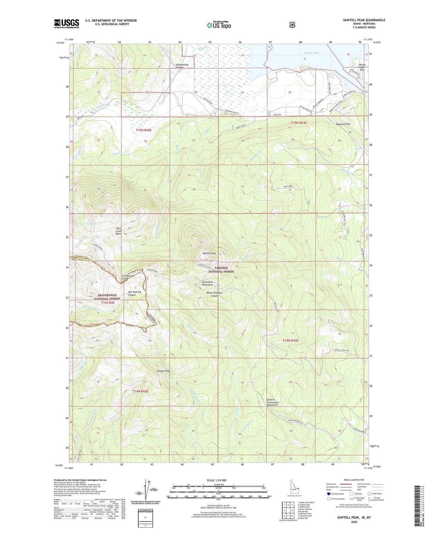
Sawtell Peak Idaho US Topo Map
Couldn't load pickup availability
Also explore the Sawtell Peak Forest Service Topo of this same quad for updated USFS data
2023 topographic map quadrangle Sawtell Peak in the state of Idaho. Scale: 1:24000. Based on the newly updated USGS 7.5' US Topo map series, this map is in the following counties: Fremont, Beaverhead. The map contains contour data, water features, and other items you are used to seeing on USGS maps, but also has updated roads and other features. This is the next generation of topographic maps. Printed on high-quality waterproof paper with UV fade-resistant inks.
Quads adjacent to this one:
West: Mount Jefferson
Northwest: Hidden Lake Bench
North: Targhee Peak
Northeast: Targhee Pass
East: Big Springs
Southeast: Island Park
South: Island Park Dam
Southwest: Icehouse Creek
Contains the following named places: Arange Peak, Bootjack Pass, Cold Spring, Hope Creek, Ingals Creek, Lake Marie, North Fork Duck Creek, Rock Creek, Rock Creek Basin, Rock Creek Pack Trail, Sawtell Peak, Schoolhouse Canyon, South Fork Duck Creek